|
search place name
|
||
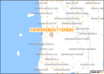
Kampong Bukit Tumboh (Kedah, Malaysia)Kampong Bukit Tumboh is a town in the Kedah region of Malaysia. An overview map of the region around Kampong Bukit Tumboh is displayed below.
regional and 3d topo map of Kampong Bukit Tumboh, Malaysia ::
Kampong Bukit Tumboh airports ::
The nearest airport is AOR - Alor Setar Sultan Abdul Halim, located 43.1 km north of Kampong Bukit Tumboh.
Other airports nearby include PEN - Penang Intl (57.3 km south), LGK - Pulau Langkawi Intl (94.6 km north west), HDY - Songkhla Hat Yai Intl (125.3 km north), PAN - Pattani (137.2 km north east), Nearby towns ::
Kampong Sungai Pagar (0.0km north) //
Kampong Tohor (0.0km north) //
Mata Ayer (1.9km north) //
Kampong Permatang Timbul (1.9km north) //
Kampong Pauh (1.8km west) //
Kampong Dusun Manggis (1.8km west) //
Kampong Lubok Kasai (1.8km west) //
Kampong Sungai Bakong (1.8km west) //
Kampong Perigi (2.6km north east) //
Kampong Paya (2.6km north east) //
Kampong Setar (2.6km north east) //
Yan Kecil (2.6km north west) //
Dusun Kapas (2.6km south west) //
Kampong Permatang Serentang (2.6km north west) //
Kampong Sulup (2.6km south west) //
Kampong Raga (2.6km south west) //
Kampong Ulu Dulang Besar (3.7km north) //
Kampong Titi Serong (3.7km north) //
Kampong Lubok Boy (3.7km west) //
Yan (3.7km west) //
Kampong Kuala Yan (3.7km west) //
Kampong Perupok (4.1km north east) //
Kampong Badak (4.1km north east) //
Kampong Pokok Ipoh (4.1km north east) //
Kampong Dulang Besar (4.1km north west) //
Kampong Kelantan (4.1km north west) //
Kampong Yan Kechil (4.1km north west) //
Kampong Sungai Raga (4.1km south west) //
Berguling (5.2km north east) //
[all distances 'as the bird flies' and approximate]  Places with similar names to Kampong Bukit Tumboh, Malaysia ::
// Kampong Bukit Tambai (BN)
// Kampong Bukit Tumboh (MY)
Disclaimer :: Information on this page comes without warranty of any kind |
||
|
Where is Kampong Bukit Tumboh? Elevation and coordinates ::
Latitude (lat): 5°48'0"N Longitude (lon): 100°24'0"E
Elevation (approx.): 147m (map arrows pan, magnifying glasses zoom) |
||
|
Visiting Kampong Bukit Tumboh? Hotel/Accommodation ::
Book a hotel in Kampong Bukit Tumboh Travel Guide ::
Buy a travel guide for Malaysia rental cars ::
car rental offers GPS waypoint ::
download a GPX waypoint (PoI) of Kampong Bukit Tumboh for your GPS receiver
|
||