|
search place name
|
||
Kampong Gong Dasar (Terengganu, Malaysia)Kampong Gong Dasar is a town in the Terengganu region of Malaysia. An overview map of the region around Kampong Gong Dasar is displayed below.
regional and 3d topo map of Kampong Gong Dasar, Malaysia ::

Kampong Gong Dasar airports ::
The nearest airport is KBR - Kota Bahru Sultan Ismail Petra, located 63.1 km north west of Kampong Gong Dasar.
Other airports nearby include TGG - Kuala Terengganu Sultan Mahmud (67.3 km south east), NAW - Narathiwat (131.2 km north west), KTE - Kerteh (157.1 km south east), PAN - Pattani (199.4 km north west), Nearby towns ::
Kampong Gong Pasir Jabi (0.0km north) //
Kampung Jabi (1.9km north) //
Kampong Bakap (1.9km north) //
Kampong Gong Besar (2.6km north east) //
Kampung Renek (3.7km east) //
Kampong Batu Balai (3.7km east) //
Kampong Oh (3.7km west) //
Jebak Puyoh (4.1km north east) //
Kampong Batang Gergaji (4.1km north west) //
Telok Suda (4.1km north west) //
Kampong Tasek Tok Lebai (5.2km north east) //
Kampong Apal Lama (5.2km north west) //
Kampong Gong Che Abu (5.5km west) //
Kampong Padang Lengkuas (5.5km east) //
Kampong Awek (5.5km west) //
Kampong Tasek Mengkuang (5.6km north) //
Kampong Kepala Gajah (5.8km east) //
Kampong Telaga Nibong (5.8km west) //
Kampung Tok Dor (5.8km east) //
Kampong Gerong (5.9km north) //
Kampong Tok Dak (5.9km north) //
Kampong Gong Lilit (5.9km north) //
Kampong Gong Tanah Merah (6.7km north west) //
Kampong Kayu Kelat (6.7km north west) //
Kampong Baroh Kua (6.7km north west) //
Kampong Gong Nangka (6.7km north west) //
Kampong Apal (6.7km north west) //
Kampong Gerai (6.7km north west) //
Kampong Gong Pasir (7.4km north) //
[all distances 'as the bird flies' and approximate] 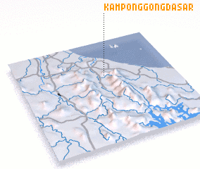 Places with similar names to Kampong Gong Dasar, Malaysia :: Disclaimer :: Information on this page comes without warranty of any kind |
||
|
Where is Kampong Gong Dasar? Elevation and coordinates ::
Latitude (lat): 5°40'0"N Longitude (lon): 102°34'0"E
Elevation (approx.): 25m (map arrows pan, magnifying glasses zoom) |
||
|
Visiting Kampong Gong Dasar? Hotel/Accommodation ::
Book a hotel in Kampong Gong Dasar Travel Guide ::
Buy a travel guide for Malaysia rental cars ::
car rental offers GPS waypoint ::
download a GPX waypoint (PoI) of Kampong Gong Dasar for your GPS receiver
|
||