|
search place name
|
||
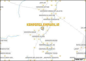
Kampong Lempur Ilir (Perak, Malaysia)Kampong Lempur Ilir is a town in the Perak region of Malaysia. An overview map of the region around Kampong Lempur Ilir is displayed below.
regional and 3d topo map of Kampong Lempur Ilir, Malaysia ::
Kampong Lempur Ilir airports ::
The nearest airport is IPH - Ipoh Sultan Azlan Shah, located 22.5 km east of Kampong Lempur Ilir.
Other airports nearby include PEN - Penang Intl (100.8 km north west), AOR - Alor Setar Sultan Abdul Halim (180.9 km north), KUL - Kuala Lumpur Intl (227.3 km south east), LGK - Pulau Langkawi Intl (228.1 km north west), Nearby towns ::
Kampong Ara Panjang (1.9km south) //
Kampong Pulai (1.8km east) //
Kampong Bukit Damar (1.8km east) //
Lempur (1.9km north) //
Kampong Jalan Badak (1.8km west) //
Kampong Tanjong Langsat (2.6km south west) //
Kampong Pachat (2.6km north east) //
Kampong Jeliang (3.7km west) //
Kampong Jilian (4.1km south west) //
Manong (4.1km south west) //
Manung (5.2km south west) //
Kampong Senggang (5.2km north east) //
Kampong Pauh (5.6km south) //
Kampong Semat (5.6km south) //
Kampong Sadik (5.8km west) //
Kampong Ulu Kenas (5.9km north) //
Kampong Teruan (5.9km south) //
Kampong Kubang Udang (5.9km south) //
Kampong Kuala Kenas (6.7km north east) //
Kampong Sementa (6.7km north east) //
Kampong Bekor (6.7km south east) //
Kampong Buloh Lidi (7.6km south) //
Kampong Mandah (8.3km south east) //
Kampong Ulu Piul (8.3km south west) //
Kampong Masjid (8.3km north east) //
Kampong Changkat Lalang (8.3km north east) //
Kampong Kubang Pekan (9.3km north east) //
Kampong Telangdengah (9.3km north east) //
Kampong Rambai Tujoh (9.2km north east) //
[all distances 'as the bird flies' and approximate]  Places with similar names to Kampong Lempur Ilir, Malaysia :: Disclaimer :: Information on this page comes without warranty of any kind |
||
|
Where is Kampong Lempur Ilir? Elevation and coordinates ::
Latitude (lat): 4°38'0"N Longitude (lon): 100°54'0"E
Elevation (approx.): 42m (map arrows pan, magnifying glasses zoom) |
||
|
Visiting Kampong Lempur Ilir? Hotel/Accommodation ::
Book a hotel in Kampong Lempur Ilir Travel Guide ::
Buy a travel guide for Malaysia rental cars ::
car rental offers GPS waypoint ::
download a GPX waypoint (PoI) of Kampong Lempur Ilir for your GPS receiver
|
||