|
search place name
|
||
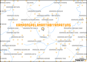
Kampong Pelaman Tabiyan Patung (Sarawak, Malaysia)Kampong Pelaman Tabiyan Patung is a town in the Sarawak region of Malaysia. An overview map of the region around Kampong Pelaman Tabiyan Patung is displayed below.
regional and 3d topo map of Kampong Pelaman Tabiyan Patung, Malaysia ::
Kampong Pelaman Tabiyan Patung airports ::
The nearest airport is KCH - Kuching Intl, located 19.0 km north of Kampong Pelaman Tabiyan Patung.
Other airports nearby include SQC - Sintang Susilo (184.2 km south east), PNK - Pontianak Supadio (195.5 km south west), SBW - Sibu (206.6 km north east), Nearby towns ::
Kampong Menjau (1.9km west) //
Kampong Pelaman Sedaun (1.9km south) //
Kampong Tijirak (2.6km north east) //
Nineteenth Mile Bazaar (2.6km north east) //
Kampong Mundai (2.6km south east) //
Kuram Musang (3.7km south) //
Kampong Mundai (3.7km south) //
Tapah 14 (3.7km south) //
Kampong Siburan (4.1km north west) //
Kampong Duuh (4.1km north east) //
Kampong Siga (4.1km north east) //
Kampong Masan (4.1km north east) //
Kampong Simboh (5.2km north west) //
Kampong Tembawang Semenong (5.2km south west) //
Kampong Sarig (5.2km south west) //
Kampong Setaang (5.6km west) //
Kampong Doras (5.6km north) //
Kampong Petag (5.9km west) //
Siburan (5.9km north) //
Kampong Maong (5.9km south) //
Kampong Sikog (6.7km north west) //
Kampong Sikog Baharu (6.7km north west) //
Kampong Batu Gong (6.7km north east) //
Kampong Mambong (6.7km north west) //
Kampung Pluman (6.7km south west) //
Twenty-Fourth Mile Bazaar (6.7km south east) //
Fifteenth Mile Bazaar (7.6km north) //
Kampong Sekeduk Baharu (7.6km north) //
Batu Gong (7.9km north east) //
[all distances 'as the bird flies' and approximate] 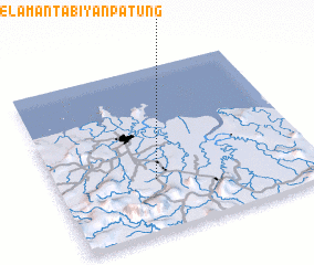 Places with similar names to Kampong Pelaman Tabiyan Patung, Malaysia :: Disclaimer :: Information on this page comes without warranty of any kind |
||
|
Where is Kampong Pelaman Tabiyan Patung? Elevation and coordinates ::
Latitude (lat): 1°19'0"N Longitude (lon): 110°23'0"E
Elevation (approx.): 28m (map arrows pan, magnifying glasses zoom) |
||
|
Visiting Kampong Pelaman Tabiyan Patung? Hotel/Accommodation ::
Book a hotel in Kampong Pelaman Tabiyan Patung Travel Guide ::
Buy a travel guide for Malaysia rental cars ::
car rental offers GPS waypoint ::
download a GPX waypoint (PoI) of Kampong Pelaman Tabiyan Patung for your GPS receiver
|
||