|
search place name
|
||
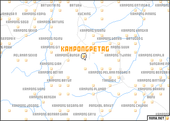
Kampong Petag (Sarawak, Malaysia)Kampong Petag is a town in the Sarawak region of Malaysia. An overview map of the region around Kampong Petag is displayed below.
regional and 3d topo map of Kampong Petag, Malaysia ::
Kampong Petag airports ::
The nearest airport is KCH - Kuching Intl, located 16.8 km north of Kampong Petag.
Other airports nearby include SQC - Sintang Susilo (189.3 km south east), PNK - Pontianak Supadio (194.0 km south west), SBW - Sibu (210.5 km north east), Nearby towns ::
Kampong Setaang (1.9km south) //
Kampong Sikog (1.9km north) //
Kampong Sikog Baharu (1.9km north) //
Kampong Simboh (2.6km north east) //
Kampong Bunga (3.7km west) //
Kampong Bewang (4.1km north west) //
Kampong Punau (4.1km north west) //
Kampong Menjau (4.1km south east) //
Kampong Siburan (4.1km north east) //
Kampong Mambong (4.1km north east) //
Kampong Benuk (5.2km south west) //
Kampong Pelaman Tabiyan Patung (5.9km east) //
Kampong Sidanu (5.9km north) //
Kampong Sarig (5.9km south) //
Kampong Tembawang Semenong (5.9km south) //
Kampong Pelaman Sedaun (6.7km south east) //
Kampong Puruh Jambu (6.7km south west) //
Kampong Sekeduk Baharu (6.7km north east) //
Fifteenth Mile Bazaar (6.7km north east) //
Kampong Doras (6.7km north east) //
Kampong Tijirak (7.4km east) //
Nineteenth Mile Bazaar (7.4km east) //
Kampong Giam (7.6km west) //
Kampung Pluman (7.6km south) //
Kampong Git (7.6km west) //
Kampong Siga (7.6km east) //
Kampong Duuh (7.6km east) //
Kampong Masan (7.6km east) //
Kampong Mundai (7.9km south east) //
[all distances 'as the bird flies' and approximate] 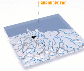 Places with similar names to Kampong Petag, Malaysia ::
Disclaimer :: Information on this page comes without warranty of any kind |
||
|
Where is Kampong Petag? Elevation and coordinates ::
Latitude (lat): 1°20'0"N Longitude (lon): 110°20'0"E
Elevation (approx.): 144m (map arrows pan, magnifying glasses zoom) |
||
|
Visiting Kampong Petag? Hotel/Accommodation ::
Book a hotel in Kampong Petag Travel Guide ::
Buy a travel guide for Malaysia rental cars ::
car rental offers GPS waypoint ::
download a GPX waypoint (PoI) of Kampong Petag for your GPS receiver
|
||