|
search place name
|
||
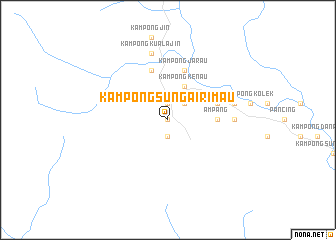
Kampong Sungai Rimau (Pahang, Malaysia)Kampong Sungai Rimau is a town in the Pahang region of Malaysia. An overview map of the region around Kampong Sungai Rimau is displayed below.
regional and 3d topo map of Kampong Sungai Rimau, Malaysia ::
Kampong Sungai Rimau airports ::
The nearest airport is KUA - Kuantan, located 23.9 km south east of Kampong Sungai Rimau.
Other airports nearby include KTE - Kerteh (82.9 km north east), TGG - Kuala Terengganu Sultan Mahmud (164.1 km north), KUL - Kuala Lumpur Intl (194.7 km south west), MKZ - Malacca (200.8 km south west), Nearby towns ::
Kampong Semeliang (0.0km north) //
Kampong Kuala Keboh (1.9km south) //
Sungai Lembing (1.9km north) //
Kampong Kolong Pahat (1.9km north) //
Myah (2.6km north east) //
Kampong Kuala Kenau (4.1km north east) //
Kampong Kenau (4.1km north east) //
Ampang (5.5km east) //
Kampong Sungai Jin (5.9km north) //
Kampong Jarau (5.9km north) //
Kampong Selat Leman (5.9km north) //
Kampong Batu Enam (5.8km east) //
Kolek (7.4km east) //
Kampong Kuala Jin (7.6km north) //
Kampong Kawah (7.6km east) //
Kampong Kuala Nada (7.6km east) //
[all distances 'as the bird flies' and approximate]  Places with similar names to Kampong Sungai Rimau, Malaysia ::
// Kampong Sungai Rambai (MY)
// Kampong Sungai Rambai (MY)
// Kampong Sungai Rambai (MY)
// Kampong Sungai Rambai (MY)
// Kampong Sungai Rambai (MY)
Disclaimer :: Information on this page comes without warranty of any kind |
||
|
Where is Kampong Sungai Rimau? Elevation and coordinates ::
Latitude (lat): 3°54'0"N Longitude (lon): 103°2'0"E
Elevation (approx.): 52m (map arrows pan, magnifying glasses zoom) |
||
|
Visiting Kampong Sungai Rimau? Hotel/Accommodation ::
Book a hotel in Kampong Sungai Rimau Travel Guide ::
Buy a travel guide for Malaysia rental cars ::
car rental offers GPS waypoint ::
download a GPX waypoint (PoI) of Kampong Sungai Rimau for your GPS receiver
|
||