|
search place name
|
||
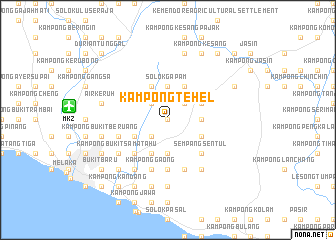
Kampong Tehel (Melaka, Malaysia)Kampong Tehel is a town in the Melaka region of Malaysia. An overview map of the region around Kampong Tehel is displayed below.
regional and 3d topo map of Kampong Tehel, Malaysia ::
Kampong Tehel airports ::
The nearest airport is MKZ - Malacca, located 11.0 km west of Kampong Tehel.
Other airports nearby include KUL - Kuala Lumpur Intl (89.8 km north west), DUM - Dumai Pinang Kampai (124.2 km south west), JHB - Johor Bahru Sultan Ismail (161.5 km south east), XSP - Singapore Seletar (192.3 km south east), Nearby towns ::
Kampong Serompong (0.0km north) //
Kampong Tengah (0.0km north) //
Kampong Parit Pelampong (0.0km north) //
Kampong Tanjong Laboh (2.6km south west) //
Kampong Gapam (2.6km north west) //
Kampong Ulu Duyong (2.6km north east) //
Solok Gapam (3.7km north) //
Tiang Dua (3.7km south) //
Sempang Bukit Kajang (3.7km east) //
Kampong Ladang Baharu (4.1km north west) //
Kampong Ayer Molek (4.1km south west) //
Kampong Pengkalan Badak (4.1km south west) //
Kampong Ayer Panas (4.1km north east) //
Bemban (4.1km north east) //
Anak Ayer Kepong (4.1km south east) //
Kampong Bemban (4.1km north east) //
Kampong Pengkalan Minyak (5.2km south west) //
Sempang Sentul (5.2km south east) //
Kampong Paya Dalam (5.6km south) //
Kampong Paya Batu Puteh (5.6km south) //
Kampong Parit Batu (5.9km south) //
Kampong Gaong (5.9km south) //
Kampong Bukit Kechil (5.9km south) //
Kampong Balik Hutan (5.9km west) //
Kampong Bukit Nibong (5.9km south) //
Kampong Paya Nibong (5.9km south) //
Kampong Bukit Sali (5.9km south) //
Kampong Permatang (6.7km south west) //
Kampong Parit Keliling (6.7km south west) //
[all distances 'as the bird flies' and approximate] 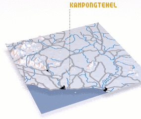 Places with similar names to Kampong Tehel, Malaysia :: Disclaimer :: Information on this page comes without warranty of any kind |
||
|
Where is Kampong Tehel? Elevation and coordinates ::
Latitude (lat): 2°15'0"N Longitude (lon): 102°21'0"E
Elevation (approx.): 31m (map arrows pan, magnifying glasses zoom) |
||
|
Visiting Kampong Tehel? Hotel/Accommodation ::
Book a hotel in Kampong Tehel Travel Guide ::
Buy a travel guide for Malaysia rental cars ::
car rental offers GPS waypoint ::
download a GPX waypoint (PoI) of Kampong Tehel for your GPS receiver
|
||