|
search place name
|
||
Pelandok Jatoh (Pulau Pinang, Malaysia)Pelandok Jatoh is a town in the Pulau Pinang region of Malaysia. An overview map of the region around Pelandok Jatoh is displayed below.
regional and 3d topo map of Pelandok Jatoh, Malaysia ::

Pelandok Jatoh airports ::
The nearest airport is PEN - Penang Intl, located 23.6 km west of Pelandok Jatoh.
Other airports nearby include AOR - Alor Setar Sultan Abdul Halim (93.3 km north), IPH - Ipoh Sultan Azlan Shah (109.7 km south east), LGK - Pulau Langkawi Intl (136.8 km north west), PAN - Pattani (175.2 km north east), Nearby towns ::
Kampong Cherok To' Kun Bawah (0.0km north) //
Pekan Baharu (0.0km north) //
Kampong Tandok (0.0km north) //
Kampong Binjai (0.0km north) //
Kampong Baharu (1.8km west) //
Kampong Pisang (1.8km east) //
Kampong Cherok To' Kun Atas (1.8km east) //
Tanah Liat (2.6km north west) //
Bukit Mertajam (2.6km north west) //
Kampong Bukit Minyak (2.6km south west) //
Kampong Kijang (2.6km south west) //
Kampong Alma (2.6km south west) //
Berapit (3.7km north) //
Batu Lintang (3.7km north) //
To' Suboh (4.1km south west) //
Kampong Uma (4.1km north west) //
Kampong Besar (4.1km north west) //
Kampong Paya (4.1km north west) //
Permatang Rawa (4.1km north west) //
Titi Panjang (4.1km south west) //
Kampong Sungai Rambai (4.1km north west) //
Pagar Teras (4.1km north east) //
Kampong Machang Bubok (4.1km south east) //
Kampong Junjong Mati (5.2km south west) //
Juru (5.2km south west) //
Gajah Mati (5.2km south east) //
Kampong Bukit Teh (5.2km south east) //
Kampong Berangan Sembilah (5.2km south east) //
Kampong Mengkuang Ulu (5.2km north east) //
[all distances 'as the bird flies' and approximate] 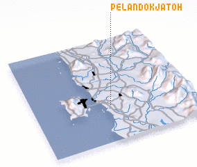 Places with similar names to Pelandok Jatoh, Malaysia :: Disclaimer :: Information on this page comes without warranty of any kind |
||
|
Where is Pelandok Jatoh? Elevation and coordinates ::
Latitude (lat): 5°21'0"N Longitude (lon): 100°29'0"E
Elevation (approx.): 25m (map arrows pan, magnifying glasses zoom) |
||
|
Visiting Pelandok Jatoh? Hotel/Accommodation ::
Book a hotel in Pelandok Jatoh Travel Guide ::
Buy a travel guide for Malaysia rental cars ::
car rental offers GPS waypoint ::
download a GPX waypoint (PoI) of Pelandok Jatoh for your GPS receiver
|
||