|
search place name
|
||
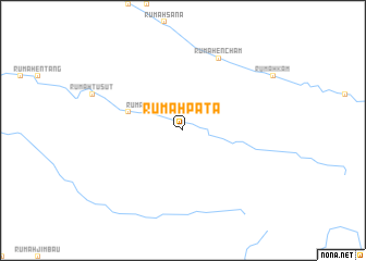
Rumah Pata (Sarawak, Malaysia)Rumah Pata is a town in the Sarawak region of Malaysia. An overview map of the region around Rumah Pata is displayed below.
regional and 3d topo map of Rumah Pata, Malaysia ::
Rumah Pata airports ::
The nearest airport is SBW - Sibu, located 49.8 km west of Rumah Pata.
Other airports nearby include BTU - Bintulu (115.1 km north east), MUR - Marudi (297.8 km north east), Nearby towns ::
Rumah Jugah (1.9km north) //
Rumah Belaiya (4.1km north west) //
Rumah Uban (4.1km north west) //
Rumah Biju (5.9km west) //
Rumah Encham (8.3km north east) //
[all distances 'as the bird flies' and approximate]  Places with similar names to Rumah Pata, Malaysia ::
// Rumah Patu (MY)
// Rumah Puti (MY)
// Rumpoăt (KH)
// Rāmpatti (BD)
// Rompido (EC)
// Rāmpatti (IN)
// Rampatai (PK)
// Rompido (HN)
// Rumpt (NL)
// Rompito (DO)
Disclaimer :: Information on this page comes without warranty of any kind |
||
|
Where is Rumah Pata? Elevation and coordinates ::
Latitude (lat): 2°16'0"N Longitude (lon): 112°26'0"E
Elevation (approx.): 106m (map arrows pan, magnifying glasses zoom) |
||
|
Visiting Rumah Pata? Hotel/Accommodation ::
Book a hotel in Rumah Pata Travel Guide ::
Buy a travel guide for Malaysia rental cars ::
car rental offers GPS waypoint ::
download a GPX waypoint (PoI) of Rumah Pata for your GPS receiver
|
||