|
search place name
|
||
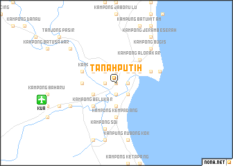
Tanah Putih (Pahang, Malaysia)Tanah Putih is a town in the Pahang region of Malaysia. An overview map of the region around Tanah Putih is displayed below.
regional and 3d topo map of Tanah Putih, Malaysia ::
nearby GPS traces from timatio ::
Tanah Putih airports ::
The nearest airport is KUA - Kuantan, located 12.3 km west of Tanah Putih.
Other airports nearby include KTE - Kerteh (82.4 km north), TGG - Kuala Terengganu Sultan Mahmud (176.6 km north), MKZ - Malacca (207.1 km south west), KUL - Kuala Lumpur Intl (213.3 km south west), Nearby towns ::
Kampong Tengah (0.0km north) //
Telok Baharu (1.8km east) //
Kampong Telok Baharu (1.8km east) //
Kuantan (1.8km east) //
Kampong Seberang Panchor (1.8km east) //
Kampung Tanjung Lumpur (1.8km east) //
Kampong Padang Kechil (1.9km north) //
Kampong Peramu (1.9km south) //
Kampung Peramu (1.9km south) //
Kampong Bukit Ubi (1.9km north) //
Kampong Darat Tanah Puteh (1.8km west) //
Kampong Lapang Besar (2.6km north east) //
Kampong Padang Lalang (2.6km north east) //
Kampung Anak Ayer (2.6km south east) //
Kampong Darat Mak Bar (2.6km north west) //
Tanjung (3.3km north east) //
Kampong Puaka (3.7km south) //
Kampong Kubang Buaya (4.1km north east) //
Kampong Selamat (4.1km north east) //
Kampong Baru (4.1km north east) //
Kampong Mak Ya (4.1km north east) //
Kampong Baharu Batu Empat (4.1km south west) //
Kampong Tiram (4.1km north west) //
Kampong Alor Akar (5.2km north east) //
Kampong Belukar (5.2km south west) //
Kampong Permatang Badak (5.5km west) //
Kampung Kempadang (5.6km south) //
Kampong Tanjong Putus (5.8km west) //
Kampong Telok Sisek (5.8km east) //
[all distances 'as the bird flies' and approximate]  Places with similar names to Tanah Putih, Malaysia ::
// Dinapit (PH)
// Tanah Puteh (MY)
// Tanah Puteh (MY)
// Taniapéta (BJ)
// Tanippādi (IN)
// Tanahputih (ID)
// Tanahputih (ID)
// Tanahputih (ID)
// Tanahputih (ID)
// Tanaputih (ID)
Disclaimer :: Information on this page comes without warranty of any kind |
||
|
Where is Tanah Putih? Elevation and coordinates ::
Latitude (lat): 3°48'0"N Longitude (lon): 103°19'0"E
Elevation (approx.): 8m (map arrows pan, magnifying glasses zoom) |
||
|
Visiting Tanah Putih? Hotel/Accommodation ::
Book a hotel in Tanah Putih Travel Guide ::
Buy a travel guide for Malaysia rental cars ::
car rental offers GPS waypoint ::
download a GPX waypoint (PoI) of Tanah Putih for your GPS receiver
|
||