|
search place name
|
||
La Candelaria (Herrera, Panama)La Candelaria is a town in the Herrera region of Panama. An overview map of the region around La Candelaria is displayed below.
regional and 3d topo map of La Candelaria, Panama ::

La Candelaria airports ::
The nearest airport is HOW - Howard, located 158.6 km north east of La Candelaria.
Other airports nearby include PAC - Panama Marcos A Gelabert Intl (166.6 km north east), PTY - Panama City Tocumen Intl (187.9 km north east), DAV - David Enrique Malek Intl (203.1 km west), BOC - Bocas Del Toro Intl (235.1 km north west), Nearby towns ::
El Pedregoso (1.8km east) //
El Pedregosito (2.6km south east) //
El Hatillo (2.6km south east) //
El Pajonal (2.6km north west) //
Llano de la Cruz (3.7km north) //
Llano de Los Reyes (4.1km south west) //
Los Lirios (4.1km north east) //
Pesé (5.2km south east) //
El Coco (5.2km south east) //
Capacho (5.2km north west) //
El Ojal (5.2km north west) //
Llano Hato (5.2km north west) //
Los Cantos (5.2km north east) //
Las Flores (5.2km north east) //
Palo Seco (5.9km north) //
El Ciruelo (5.9km south) //
Pueblo Nuevo (5.9km north) //
Guaymie (5.8km west) //
La Polonia (5.8km west) //
Santo Domingo (5.9km north) //
Sabana Grande (5.9km south) //
Llano del Río (5.8km east) //
Las Manuelas (6.7km north west) //
El Hatillito (6.6km south west) //
La Trinidaíta (6.6km south west) //
Cerro Pelado (6.7km south east) //
Ojo de Agua (6.7km north east) //
Llano Grande (6.6km north west) //
Las Palmas (6.6km north west) //
[all distances 'as the bird flies' and approximate] 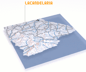 Places with similar names to La Candelaria, Panama ::
// La Candelaria (PA)
// La Candelaria (PA)
// La Candelaria (PA)
// La Candelaria (PA)
// La Candelaria (PA)
// La Candelaria (CU)
// La Candelaria (CU)
// La Candelaria (CU)
// La Candelaria (CU)
// La Candelaria (CU)
Disclaimer :: Information on this page comes without warranty of any kind |
||
|
Where is La Candelaria? Elevation and coordinates ::
Latitude (lat): 7°56'0"N Longitude (lon): 80°39'0"W
Elevation (approx.): 48m (map arrows pan, magnifying glasses zoom) |
||
|
Visiting La Candelaria? Hotel/Accommodation ::
Book a hotel in La Candelaria Travel Guide ::
Buy a travel guide for Panama rental cars ::
car rental offers GPS waypoint ::
download a GPX waypoint (PoI) of La Candelaria for your GPS receiver
|
||