|
search place name
|
||
La Casanga (Herrera, Panama)La Casanga is a town in the Herrera region of Panama. An overview map of the region around La Casanga is displayed below.
regional and 3d topo map of La Casanga, Panama ::

La Casanga airports ::
The nearest airport is DAV - David Enrique Malek Intl, located 180.6 km west of La Casanga.
Other airports nearby include HOW - Howard (182.8 km north east), PAC - Panama Marcos A Gelabert Intl (190.7 km north east), PTY - Panama City Tocumen Intl (212.2 km north east), BOC - Bocas Del Toro Intl (221.9 km north west), Nearby towns ::
La Iguana (1.9km north) //
El Balita (1.9km north) //
Entradero de Tijeras (1.8km east) //
Los Negros (1.9km south) //
Cerro de Paja (1.8km west) //
Las Culebras (1.8km west) //
Quebrada Borrigueros (1.8km west) //
Los Higos (2.6km north east) //
El Borriguero (2.6km south east) //
El Palenque (2.6km south west) //
El Calvario (2.6km south west) //
El Corcovado (3.7km north) //
Las Huertas (3.7km east) //
Los Pérez (4.1km north east) //
El Barrigón (4.1km north east) //
Ave María (4.1km north east) //
Cerro Colorado (4.1km south east) //
Entradero de Ángulo (4.1km south east) //
Alto del Castillo (4.1km south east) //
Los Calabacitos (4.1km south east) //
Boquerón (4.1km north west) //
El Pájaro (4.1km south east) //
Cerro Prieto (5.2km north east) //
El Barrero Número Dos (5.2km north east) //
La Quisama (5.2km north west) //
Limón de Tijeras (5.2km south west) //
Loma Larga (5.5km west) //
Tijeras (5.5km west) //
Los Cañafístulos (5.5km east) //
[all distances 'as the bird flies' and approximate] 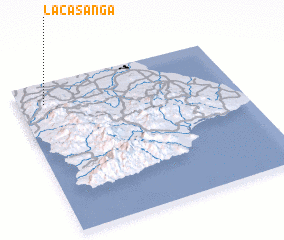 Places with similar names to La Casanga, Panama ::
// Łącznik (PL)
// Łączonek (PL)
// Łucznica (PL)
// Łyczanka (PL)
// Lieke-Asangu (CD)
// Lakh Sang (IR)
// Lacsanga (PE)
// Liuxiang (CN)
// Liuxiang (CN)
// Lạc Sơn (2) (VN)
Disclaimer :: Information on this page comes without warranty of any kind |
||
|
Where is La Casanga? Elevation and coordinates ::
Latitude (lat): 7°52'0"N Longitude (lon): 80°53'0"W
Elevation (approx.): 182m (map arrows pan, magnifying glasses zoom) |
||
|
Visiting La Casanga? Hotel/Accommodation ::
Book a hotel in La Casanga Travel Guide ::
Buy a travel guide for Panama rental cars ::
car rental offers GPS waypoint ::
download a GPX waypoint (PoI) of La Casanga for your GPS receiver
|
||