|
search place name
|
||
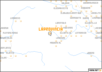
La Provincia (Los Santos, Panama)La Provincia is a town in the Los Santos region of Panama. An overview map of the region around La Provincia is displayed below.
regional and 3d topo map of La Provincia, Panama ::
La Provincia airports ::
The nearest airport is HOW - Howard, located 202.7 km north east of La Provincia.
Other airports nearby include PAC - Panama Marcos A Gelabert Intl (210.8 km north east), DAV - David Enrique Malek Intl (220.3 km north west), PTY - Panama City Tocumen Intl (230.9 km north east), BOC - Bocas Del Toro Intl (272.6 km north west), Nearby towns ::
Marroquín (1.9km north) //
El Pilón (2.6km south east) //
El Naranjito (3.7km east) //
Las Vidas (4.1km south east) //
Maquencal (4.1km south east) //
La Pita (4.1km north east) //
Los Aromos (4.1km north east) //
Bajo Grande (5.2km north east) //
La Pintada (5.2km north east) //
El Cortezo (5.5km east) //
Los Chiqueros (5.8km east) //
Aquira (6.6km north east) //
El Plan de Concho (7.4km east) //
El Cortezo Abajo (7.4km east) //
Aguas Calientes (7.6km east) //
El Bajo de la Pintada (10.4km north east) //
Boca del Toro (10.4km north east) //
[all distances 'as the bird flies' and approximate]  Places with similar names to La Provincia, Panama ::
// La Provincia (GT)
// La Pervenche (FR)
Disclaimer :: Information on this page comes without warranty of any kind |
||
|
Where is La Provincia? Elevation and coordinates ::
Latitude (lat): 7°26'0"N Longitude (lon): 80°41'0"W
Elevation (approx.): 519m (map arrows pan, magnifying glasses zoom) |
||
|
Visiting La Provincia? Hotel/Accommodation ::
Book a hotel in La Provincia Travel Guide ::
Buy a travel guide for Panama rental cars ::
car rental offers GPS waypoint ::
download a GPX waypoint (PoI) of La Provincia for your GPS receiver
|
||