|
search place name
|
||
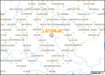
La Tinaja (Coclé, Panama)La Tinaja is a town in the Coclé region of Panama. An overview map of the region around La Tinaja is displayed below.
regional and 3d topo map of La Tinaja, Panama ::
La Tinaja airports ::
The nearest airport is HOW - Howard, located 140.1 km north east of La Tinaja.
Other airports nearby include PAC - Panama Marcos A Gelabert Intl (147.7 km north east), PTY - Panama City Tocumen Intl (169.5 km north east), DAV - David Enrique Malek Intl (193.6 km west), BOC - Bocas Del Toro Intl (210.5 km north west), Nearby towns ::
Las Mieles (1.8km east) //
Los Rincones (1.9km north) //
La Cruz (2.6km south west) //
El Pinzón (2.6km north west) //
Los Callejones (3.7km north) //
El Hato de San Juan de Dios (4.1km north east) //
Los Volcanes (4.1km north east) //
El Picacho (4.1km north east) //
Vista Hermosa (4.1km south west) //
La Lucía (4.1km south west) //
La Cotava Arriba (4.1km south west) //
La Puente (4.1km north west) //
Cocobó Abajo (4.1km south west) //
El Macho (5.2km north west) //
Cicuaro (5.2km north west) //
Piña (5.2km north west) //
El Recodo (5.2km north west) //
La Candelaria (5.2km south west) //
La Cotava Abajo (5.2km south west) //
La Poza (5.5km east) //
Maizón (5.5km west) //
Cerro Gordo (5.6km north) //
Ingenio Santa Rosa (5.9km south) //
Perequé (5.8km west) //
Los Pozos (5.8km west) //
Llano Sánchez (5.9km south) //
El Mono (5.9km north) //
El Bolo (5.9km north) //
Corotú (6.6km north west) //
[all distances 'as the bird flies' and approximate] 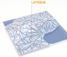 Places with similar names to La Tinaja, Panama ::
Disclaimer :: Information on this page comes without warranty of any kind |
||
|
Where is La Tinaja? Elevation and coordinates ::
Latitude (lat): 8°15'0"N Longitude (lon): 80°41'0"W
Elevation (approx.): 120m (map arrows pan, magnifying glasses zoom) |
||
|
Visiting La Tinaja? Hotel/Accommodation ::
Book a hotel in La Tinaja Travel Guide ::
Buy a travel guide for Panama rental cars ::
car rental offers GPS waypoint ::
download a GPX waypoint (PoI) of La Tinaja for your GPS receiver
|
||