|
search place name
|
||
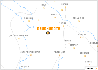
Abū Ghurayb (Şalāḩ ad Dīn, Iraq)Abū Ghurayb is a town in the Şalāḩ ad Dīn region of Iraq. An overview map of the region around Abū Ghurayb is displayed below.
regional and 3d topo map of Abū Ghurayb, Iraq ::
Nearby towns ::
Sārhah (5.7km north east) //
Dāmīr Qābū (6.5km north west) //
Thuşaylib (7.0km north) //
Tayāwī (7.1km south east) //
Injānah (8.3km south east) //
Towa Zalmir (8.3km south east) //
Shammākh (8.2km north west) //
Ḩusayn Ibn Ḩumayyid (9.5km south west) //
[all distances 'as the bird flies' and approximate]  Places with similar names to Abū Ghurayb, Iraq ::
// Abū Gharb (IQ)
// Abū Gharb (IQ)
// Abū Gharīb (IQ)
// Abū Ghurāb (IQ)
// Abū Ghurayb (IQ)
// Āb-e Gheyrūb (IR)
// Abū Gharīb (IR)
// Abū Gharīb (IR)
// Abū Ghurayb (IQ)
Disclaimer :: Information on this page comes without warranty of any kind |
||
|
Where is Abū Ghurayb? Elevation and coordinates ::
Latitude (lat): 34°33'6"N Longitude (lon): 44°35'47"E
Elevation (approx.): 149m (map arrows pan, magnifying glasses zoom) |
||
|
Visiting Abū Ghurayb? Hotel/Accommodation ::
Book a hotel in Abū Ghurayb Travel Guide ::
Buy a travel guide for Iraq rental cars ::
car rental offers GPS waypoint ::
download a GPX waypoint (PoI) of Abū Ghurayb for your GPS receiver
|
||