|
search place name
|
||
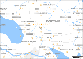
Albū Yūsuf (Dhī Qār, Iraq)Albū Yūsuf is a town in the Dhī Qār region of Iraq. An overview map of the region around Albū Yūsuf is displayed below.
regional and 3d topo map of Albū Yūsuf, Iraq ::
Albū Yūsuf airports ::
The nearest airport is BSR - Basrah Intl, located 147.3 km south east of Albū Yūsuf.
Other airports nearby include ABD - Abadan (204.8 km south east), KWI - Kuwait Intl (267.3 km south east), Nearby towns ::
Ash Shufayjāt (1.1km south) //
Ḩusayn ash Shāya (3.7km south) //
Khalaf ash Shadhr (4.8km south) //
Ghudayr (5.2km south west) //
Ālbū ‘Uwayd (5.1km south west) //
Khalaf az Zurayj (5.7km north east) //
Şāliḩ (5.7km south east) //
Qal‘at Sayyid Amīn (5.4km north east) //
Kharābat adh Dhahab (5.5km south east) //
Muḩammad al ‘Ulayb (5.5km north west) //
Khalīl al Bāshā (6.4km north) //
Jabbār as Sa‘īd (6.5km west) //
Sayyid Yūsuf (6.5km west) //
Ālbū Ḩawālah (7.0km west) //
Muḩsin an Nayyār (8.0km south west) //
Jabr (8.4km north) //
Nāşir (8.1km south east) //
Qal‘at Ḩawlī (8.2km south west) //
Shaykh Qat‘ī al Bāţī (8.2km south west) //
Albū Kuraydī (8.9km south east) //
‘Aţramah (9.4km north east) //
Muḩammad (9.7km south east) //
‘Alī as Sālim (10.8km south east) //
[all distances 'as the bird flies' and approximate] 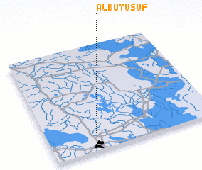 Places with similar names to Albū Yūsuf, Iraq :: Disclaimer :: Information on this page comes without warranty of any kind |
||
|
Where is Albū Yūsuf? Elevation and coordinates ::
Latitude (lat): 31°8'34"N Longitude (lon): 46°17'4"E
Elevation (approx.): 6m (map arrows pan, magnifying glasses zoom) |
||
|
Visiting Albū Yūsuf? Hotel/Accommodation ::
Book a hotel in Albū Yūsuf Travel Guide ::
Buy a travel guide for Iraq rental cars ::
car rental offers GPS waypoint ::
download a GPX waypoint (PoI) of Albū Yūsuf for your GPS receiver
|
||