|
search place name
|
||
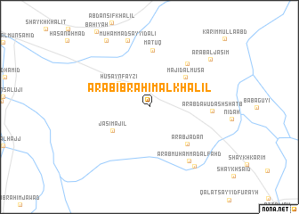
‘Arab Ibrāhīm al Khalīl (Diyālá, Iraq)‘Arab Ibrāhīm al Khalīl is a town in the Diyālá region of Iraq. An overview map of the region around ‘Arab Ibrāhīm al Khalīl is displayed below.
regional and 3d topo map of ‘Arab Ibrāhīm al Khalīl, Iraq ::
‘Arab Ibrāhīm al Khalīl airports ::
The nearest airport is KSH - Bakhtaran Shahid Ashrafi Esfahani, located 184.6 km east of ‘Arab Ibrāhīm al Khalīl.
Other airports nearby include SDG - Sanandaj (223.7 km north east), Nearby towns ::
Ḩusayn Fayzī (4.4km north west) //
Jāsim ‘Ajīl (4.8km south west) //
Majīd al Mūsá (5.3km north east) //
‘Arab Jad‘ān (6.0km south east) //
Ma‘tūq (7.1km north) //
Karīm al Haymūs (6.6km north east) //
‘Arab Dāwūd ash Shaţb (6.6km east) //
‘Arab Muḩammad al Fahd (8.0km south east) //
Muḩammad Sayyid ‘Alī (8.6km north) //
‘Arab al Faḩḩām (8.8km south east) //
‘Arab al Jāsim (8.7km north east) //
Duwij (9.4km north west) //
[all distances 'as the bird flies' and approximate] 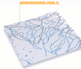 Places with similar names to ‘Arab Ibrāhīm al Khalīl, Iraq :: Disclaimer :: Information on this page comes without warranty of any kind |
||
|
Where is ‘Arab Ibrāhīm al Khalīl? Elevation and coordinates ::
Latitude (lat): 33°51'8"N Longitude (lon): 45°14'50"E
Elevation (approx.): 61m (map arrows pan, magnifying glasses zoom) |
||
|
Visiting ‘Arab Ibrāhīm al Khalīl? Hotel/Accommodation ::
Book a hotel in ‘Arab Ibrāhīm al Khalīl Travel Guide ::
Buy a travel guide for Iraq rental cars ::
car rental offers GPS waypoint ::
download a GPX waypoint (PoI) of ‘Arab Ibrāhīm al Khalīl for your GPS receiver
|
||