|
search place name
|
||
Chardāghlū (At Taʼmīm, Iraq)Chardāghlū is a town in the At Taʼmīm region of Iraq. An overview map of the region around Chardāghlū is displayed below.
regional and 3d topo map of Chardāghlū, Iraq ::

Nearby towns ::
Shūrījah (3.1km north) //
Tar Kalān (4.9km north west) //
Topzāwa (5.4km north west) //
Tāza Khurmātū (6.0km south) //
Sārī Tappah Kuchūk (5.6km east) //
Zindānah (6.3km south east) //
Qarah Yāl (7.7km south) //
Maryam Bak (7.1km south west) //
Ţāwūq Māqlū (7.2km east) //
Ḩāzim (7.6km west) //
Ḩişār Şaghīr Muḩammad (8.2km north east) //
Jadīdah (10.7km north west) //
[all distances 'as the bird flies' and approximate] 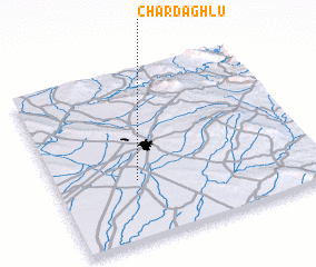 Places with similar names to Chardāghlū, Iraq ::
Disclaimer :: Information on this page comes without warranty of any kind |
||
|
Where is Chardāghlū? Elevation and coordinates ::
Latitude (lat): 35°21'19"N Longitude (lon): 44°18'47"E
Elevation (approx.): 262m (map arrows pan, magnifying glasses zoom) |
||
|
Visiting Chardāghlū? Hotel/Accommodation ::
Book a hotel in Chardāghlū Travel Guide ::
Buy a travel guide for Iraq rental cars ::
car rental offers GPS waypoint ::
download a GPX waypoint (PoI) of Chardāghlū for your GPS receiver
|
||