|
search place name
|
||
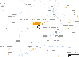
Dōbiryā (As Sulaymānīyah, Iraq)Dōbiryā is a town in the As Sulaymānīyah region of Iraq. An overview map of the region around Dōbiryā is displayed below.
regional and 3d topo map of Dōbiryā, Iraq ::
Dōbiryā airports ::
The nearest airport is SDG - Sanandaj, located 165.2 km east of Dōbiryā.
Other airports nearby include KSH - Bakhtaran Shahid Ashrafi Esfahani (200.6 km south east), Nearby towns ::
Kārēza-i Dilō (1.7km north east) //
Ḩasan Ganūsh Qulī (3.6km west) //
Jami Raz (4.6km south) //
Rash (4.7km north west) //
Panj Angusht-i ʼājī Aḩmad Āghā (4.7km north east) //
Panj Anghusht-i Shaykh Muşţafá (5.2km north) //
Jamrēz-i Hājī Muşţafá (4.5km east) //
Tappah ‘Arab (4.8km west) //
Aynka-i Sa‘id-a Rash (6.0km north west) //
Doāb (6.7km east) //
Kyūwī (8.0km south) //
Kichēn-i Kōn (8.3km north east) //
Timār (8.1km north east) //
MastūI Hama Faraj (8.6km south east) //
Zindāna (8.1km north east) //
[all distances 'as the bird flies' and approximate] 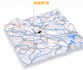 Places with similar names to Dōbiryā, Iraq ::
Disclaimer :: Information on this page comes without warranty of any kind |
||
|
Where is Dōbiryā? Elevation and coordinates ::
Latitude (lat): 35°9'21"N Longitude (lon): 45°11'56"E
Elevation (approx.): 636m (map arrows pan, magnifying glasses zoom) |
||
|
Visiting Dōbiryā? Hotel/Accommodation ::
Book a hotel in Dōbiryā Travel Guide ::
Buy a travel guide for Iraq rental cars ::
car rental offers GPS waypoint ::
download a GPX waypoint (PoI) of Dōbiryā for your GPS receiver
|
||