|
search place name
|
||
Ḩayy al Akrād (Al Qādisīyah, Iraq)Ḩayy al Akrād is a town in the Al Qādisīyah region of Iraq. An overview map of the region around Ḩayy al Akrād is displayed below.
regional and 3d topo map of Ḩayy al Akrād, Iraq ::

Nearby towns ::
Ḩamzah Āl Farḩān (2.2km south) //
Rājī Āl Chalāb (2.5km south) //
Jalāl Āl Raţān (3.0km south) //
Salmān Āl Sharmāhī (3.6km south) //
Āl ‘Abbūd (4.2km south) //
Ḩājjī Ḩusayn (4.6km north) //
Yāsir Āl Sharmāhī (4.7km south) //
Ash Shahīd Şāḩib ar Ramāḩī (5.5km south) //
Ḩusayn Mashkūr (5.9km south) //
Ad Dīwānīyah (6.0km north west) //
Al ‘Aţāʼ (5.7km west) //
Sayyid Ḩāmid (6.6km south west) //
[all distances 'as the bird flies' and approximate] 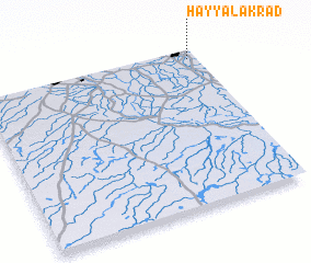 Places with similar names to Ḩayy al Akrād, Iraq ::
// Hale Court (US)
// Hilkerode (DE)
// Hilgard (US)
// Haillicourt (FR)
// Heillecourt (FR)
// Holacourt (FR)
// Huilliécourt (FR)
// Hallagärde (SE)
// Holgryte (SE)
// Holkaryd (SE)
Disclaimer :: Information on this page comes without warranty of any kind |
||
|
Where is Ḩayy al Akrād? Elevation and coordinates ::
Latitude (lat): 31°56'37"N Longitude (lon): 44°57'43"E
Elevation (approx.): 21m (map arrows pan, magnifying glasses zoom) |
||
|
Visiting Ḩayy al Akrād? Hotel/Accommodation ::
Book a hotel in Ḩayy al Akrād Travel Guide ::
Buy a travel guide for Iraq rental cars ::
car rental offers GPS waypoint ::
download a GPX waypoint (PoI) of Ḩayy al Akrād for your GPS receiver
|
||