|
search place name
|
||
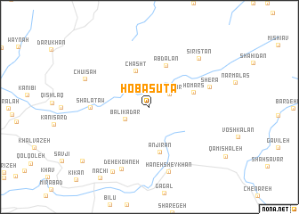
Hoba Sūta (As Sulaymānīyah, Iraq)Hoba Sūta is a town in the As Sulaymānīyah region of Iraq. An overview map of the region around Hoba Sūta is displayed below.
regional and 3d topo map of Hoba Sūta, Iraq ::
Hoba Sūta airports ::
The nearest airport is SDG - Sanandaj, located 92.4 km south east of Hoba Sūta.
Other airports nearby include KSH - Bakhtaran Shahid Ashrafi Esfahani (177.8 km south east), Nearby towns ::
Lalādar (2.6km north east) //
Bālīkadar (3.0km south west) //
Chāsht (4.8km north) //
Abdālān (5.5km north) //
Anjīrān (5.7km south) //
Homars (4.9km east) //
Shālataw (6.0km west) //
Shera (6.6km east) //
Hāneh Sheykhān (8.4km south) //
Deh-e Kohneh (8.3km south) //
Sīristān (7.8km north east) //
Chūīsah (7.5km north west) //
Darrehvarān (8.9km south west) //
Mīrgah-e Derīzh (9.6km south west) //
Nachī (10.2km south west) //
[all distances 'as the bird flies' and approximate] 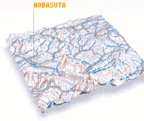
Disclaimer :: Information on this page comes without warranty of any kind |
||
|
Where is Hoba Sūta? Elevation and coordinates ::
Latitude (lat): 35°44'0"N Longitude (lon): 46°11'0"E
Elevation (approx.): 1566m (map arrows pan, magnifying glasses zoom) |
||
|
Visiting Hoba Sūta? Hotel/Accommodation ::
Book a hotel in Hoba Sūta Travel Guide ::
Buy a travel guide for Iraq rental cars ::
car rental offers GPS waypoint ::
download a GPX waypoint (PoI) of Hoba Sūta for your GPS receiver
|
||