|
search place name
|
||
Ibrāhīm Āghā (As Sulaymānīyah, Iraq)Ibrāhīm Āghā is a town in the As Sulaymānīyah region of Iraq. An overview map of the region around Ibrāhīm Āghā is displayed below.
regional and 3d topo map of Ibrāhīm Āghā, Iraq ::
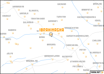
Nearby towns ::
Gilālī (2.3km north east) //
Sēdān (2.8km north west) //
Ḩamzah (2.8km east) //
Bīnah (3.0km south west) //
Bangard (3.8km south) //
Sēdān (3.5km west) //
Dānāsafi (4.6km north) //
Turkīyah (6.8km north east) //
Kānī Kochātah (6.2km east) //
Yakhtah Khān (6.9km north west) //
Qarah Hinjīrah (8.1km south) //
Mahmūd Khāta (6.9km north west) //
Chamchamal (7.3km south east) //
Gurgayi-i-‘Arab Chāwush (7.5km south west) //
Gulʼmkāwa (8.0km north west) //
Muz̧affar (9.4km south east) //
Ali Mʼkāyil (9.9km north west) //
[all distances 'as the bird flies' and approximate] 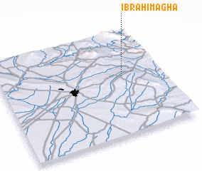 Places with similar names to Ibrāhīm Āghā, Iraq ::
Disclaimer :: Information on this page comes without warranty of any kind |
||
|
Where is Ibrāhīm Āghā? Elevation and coordinates ::
Latitude (lat): 35°34'23"N Longitude (lon): 44°45'55"E
Elevation (approx.): 671m (map arrows pan, magnifying glasses zoom) |
||
|
Visiting Ibrāhīm Āghā? Hotel/Accommodation ::
Book a hotel in Ibrāhīm Āghā Travel Guide ::
Buy a travel guide for Iraq rental cars ::
car rental offers GPS waypoint ::
download a GPX waypoint (PoI) of Ibrāhīm Āghā for your GPS receiver
|
||