|
search place name
|
||
Jadīdah (At Taʼmīm, Iraq)Jadīdah is a town in the At Taʼmīm region of Iraq. An overview map of the region around Jadīdah is displayed below.
regional and 3d topo map of Jadīdah, Iraq ::
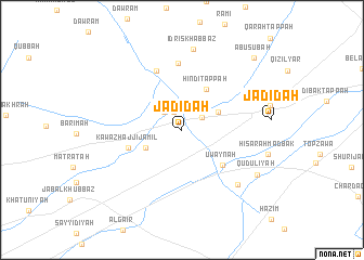
Nearby towns ::
Al Buwaytīr (2.0km north) //
Ash Sharīfīyah (2.1km north east) //
Habītar (2.4km north west) //
Yangī Damlār (3.5km north east) //
Kawāz Qarah Bayt (3.5km south west) //
Hindī Tappah (4.7km north east) //
‘Uwaynah (5.0km south east) //
Kawāz Ḩājjī Jamīl (4.9km west) //
Mullā ‘Abd Allāh (6.4km north) //
Idrīs Sulţān (6.8km north) //
Sayyid ‘Alī (7.3km south east) //
Idrīs Khabbāz (8.4km north) //
Qudūlīyah (7.8km south east) //
Ḩişār Aḩmad Bak (7.7km east) //
Abū Şubāḩ (9.6km north east) //
[all distances 'as the bird flies' and approximate]  Places with similar names to Jadīdah, Iraq ::
Disclaimer :: Information on this page comes without warranty of any kind |
||
|
Where is Jadīdah? Elevation and coordinates ::
Latitude (lat): 35°25'0"N Longitude (lon): 44°9'0"E
Elevation (approx.): 247m (map arrows pan, magnifying glasses zoom) |
||
|
Visiting Jadīdah? Hotel/Accommodation ::
Book a hotel in Jadīdah Travel Guide ::
Buy a travel guide for Iraq rental cars ::
car rental offers GPS waypoint ::
download a GPX waypoint (PoI) of Jadīdah for your GPS receiver
|
||