|
search place name
|
||
Khūrmālah (Arbīl, Iraq)Khūrmālah is a town in the Arbīl region of Iraq. An overview map of the region around Khūrmālah is displayed below.
regional and 3d topo map of Khūrmālah, Iraq ::
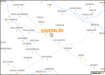
Nearby towns ::
Shūrījah (2.2km north west) //
Chil Hewēza (2.7km south east) //
Chardāq (4.0km north east) //
Harak (5.6km north west) //
Khaznah (5.7km west) //
Dībagah (6.5km south east) //
Yadīqū (7.3km north west) //
Şūfī Ismā‘īl (7.9km south) //
Mājid Yūnus (7.0km west) //
Kōzah Pankah (7.7km south west) //
Halāwah (9.0km north) //
Dūshwān (10.8km south west) //
[all distances 'as the bird flies' and approximate]  Places with similar names to Khūrmālah, Iraq ::
// Khūrmāl (IQ)
// Khoramaly (RU)
// Khoramaly (RU)
// Khormaly (RU)
// Khurmuli (RU)
// Khormul (IN)
// Khormālū (IR)
// Kharai Mela (PK)
// Khawr Ma‘lā (AE)
Disclaimer :: Information on this page comes without warranty of any kind |
||
|
Where is Khūrmālah? Elevation and coordinates ::
Latitude (lat): 35°55'10"N Longitude (lon): 43°45'35"E
Elevation (approx.): 354m (map arrows pan, magnifying glasses zoom) |
||
|
Visiting Khūrmālah? Hotel/Accommodation ::
Book a hotel in Khūrmālah Travel Guide ::
Buy a travel guide for Iraq rental cars ::
car rental offers GPS waypoint ::
download a GPX waypoint (PoI) of Khūrmālah for your GPS receiver
|
||