|
search place name
|
||
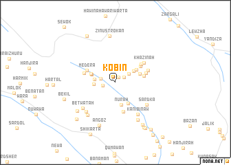
Kōbīn (As Sulaymānīyah, Iraq)Kōbīn is a town in the As Sulaymānīyah region of Iraq. An overview map of the region around Kōbīn is displayed below.
regional and 3d topo map of Kōbīn, Iraq ::
Kōbīn airports ::
The nearest airport is TBZ - Tabriz Intl, located 234.4 km north east of Kōbīn.
Nearby towns ::
Balangāz (0.9km north east) //
Sārah (1.4km north east) //
Bardānga (1.7km west) //
Gozkalān (2.0km west) //
Qalāt (2.2km north east) //
Nāwazīnān (2.8km west) //
Mōlakān (3.0km north east) //
Bardabī (2.8km west) //
Nūrah (3.7km south) //
Dilera (3.8km south east) //
Binjār (3.4km north east) //
Shakala (3.3km north west) //
Shīrūt (3.5km north east) //
Gūlān (3.5km north west) //
Dahrūkah (3.9km east) //
Chōm (4.2km north east) //
Qalah Saydah (4.8km south) //
Mēdēra (4.2km north west) //
Dirāskut (4.4km north east) //
Samāka (4.2km east) //
Gūlān (4.3km west) //
Khazīnah (4.9km north east) //
Spiyāw (4.7km north east) //
Sārdka (5.5km south east) //
Kānī Bināw (6.0km south east) //
Andīk (6.0km south west) //
Betwātah (6.0km south west) //
Āmānj (6.4km south west) //
Tōpzāwa (6.7km south east) //
[all distances 'as the bird flies' and approximate]  Places with similar names to Kōbīn, Iraq ::
Disclaimer :: Information on this page comes without warranty of any kind |
||
|
Where is Kōbīn? Elevation and coordinates ::
Latitude (lat): 36°22'56"N Longitude (lon): 44°45'29"E
Elevation (approx.): 863m (map arrows pan, magnifying glasses zoom) |
||
|
Visiting Kōbīn? Hotel/Accommodation ::
Book a hotel in Kōbīn Travel Guide ::
Buy a travel guide for Iraq rental cars ::
car rental offers GPS waypoint ::
download a GPX waypoint (PoI) of Kōbīn for your GPS receiver
|
||