|
search place name
|
||
Maţ‘ūs al Mahnīyah (Dhī Qār, Iraq)Maţ‘ūs al Mahnīyah is a town in the Dhī Qār region of Iraq. An overview map of the region around Maţ‘ūs al Mahnīyah is displayed below.
regional and 3d topo map of Maţ‘ūs al Mahnīyah, Iraq ::

Maţ‘ūs al Mahnīyah airports ::
The nearest airport is BSR - Basrah Intl, located 130.6 km east of Maţ‘ūs al Mahnīyah.
Other airports nearby include ABD - Abadan (188.4 km east), KWI - Kuwait Intl (242.8 km south east), Nearby towns ::
Maz‘al (1.5km east) //
Abū ‘Ajīlah (1.9km north) //
Bu‘ayyin (4.0km north west) //
‘Awdat al Wahhābī (4.6km north) //
Salaf (4.9km north east) //
Ḩujrat Mulayḩah (4.9km south west) //
‘Abd Allāh (4.8km east) //
Thāmir Bak (5.3km south east) //
Jabal al Ḩumar (5.1km west) //
Ghumays (6.4km south east) //
Salaf Karīm (6.4km north east) //
Īshān Abū Şalābīkh (7.6km south) //
Salaf Zair (7.7km north) //
Khidn al Fāris (7.4km north east) //
Sayyid Mahdī (7.4km north west) //
Sakar (8.4km south east) //
Shuwaykīyah (8.8km north west) //
Makhlaf (9.8km south east) //
‘Uşfūrīyah (9.8km north west) //
[all distances 'as the bird flies' and approximate] 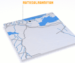 Places with similar names to Maţ‘ūs al Mahnīyah, Iraq :: Disclaimer :: Information on this page comes without warranty of any kind |
||
|
Where is Maţ‘ūs al Mahnīyah? Elevation and coordinates ::
Latitude (lat): 30°55'0"N Longitude (lon): 46°22'0"E
Elevation (approx.): 3m (map arrows pan, magnifying glasses zoom) |
||
|
Visiting Maţ‘ūs al Mahnīyah? Hotel/Accommodation ::
Book a hotel in Maţ‘ūs al Mahnīyah Travel Guide ::
Buy a travel guide for Iraq rental cars ::
car rental offers GPS waypoint ::
download a GPX waypoint (PoI) of Maţ‘ūs al Mahnīyah for your GPS receiver
|
||