|
search place name
|
||
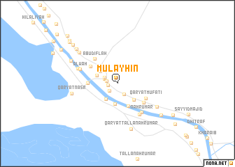
Mulayḩin (Al Başrah, Iraq)Mulayḩin is a town in the Al Başrah region of Iraq. An overview map of the region around Mulayḩin is displayed below.
regional and 3d topo map of Mulayḩin, Iraq ::
Mulayḩin airports ::
The nearest airport is BSR - Basrah Intl, located 27.6 km south of Mulayḩin.
Other airports nearby include ABD - Abadan (74.9 km south east), AWZ - Ahwaz (124.4 km north east), MRX - Bandar Mahshahr Mahshahr (149.1 km east), KWI - Kuwait Intl (177.2 km south), Nearby towns ::
Al Lāfīyah (1.3km west) //
Bayt Riḑāʼ (1.6km south west) //
Sayyid Jābir (1.5km west) //
Abū Gharb (1.9km south east) //
Ash Shahbān (1.9km north west) //
Madīnah (2.0km north west) //
An Nashwah (2.7km north west) //
Minţaqat an Nahrān (3.0km south west) //
Rumaylah (3.3km south) //
Qaryat Yazdū (3.1km north west) //
Ḩājj Manşūr (3.0km north west) //
Qaryat Sayyid Mushīḩ (3.5km south east) //
Abū al Ḩayyah (3.9km south) //
Nāḩiyat ad Dayr (4.1km west) //
Qaryat al Bayjīyah (4.6km north west) //
Qaryat Mufātī (4.5km south east) //
Sulaymānīyah (4.8km south east) //
Abū Diflah (5.0km north west) //
‘Ammān (5.8km south east) //
Nahr ‘Umar (5.7km south east) //
‘Alwah (5.6km north west) //
Qaryat ash Shayfīyah (5.9km north west) //
Qaryat az Zurayjī (6.6km south east) //
Qaryat Naşr (6.5km west) //
Qaryat Ţallā‘ Nahr ‘Umar (7.5km south) //
Qaryat ash Sharāmkhah (7.2km north west) //
Qaryat ash Sharāmkhah (7.3km north west) //
Qaryat al Ḩawāfir (7.9km north west) //
Ḩusnīyah (7.9km south east) //
[all distances 'as the bird flies' and approximate]  Places with similar names to Mulayḩin, Iraq ::
Disclaimer :: Information on this page comes without warranty of any kind |
||
|
Where is Mulayḩin? Elevation and coordinates ::
Latitude (lat): 30°47'45"N Longitude (lon): 47°37'14"E
Elevation (approx.): 4m (map arrows pan, magnifying glasses zoom) |
||
|
Visiting Mulayḩin? Hotel/Accommodation ::
Book a hotel in Mulayḩin Travel Guide ::
Buy a travel guide for Iraq rental cars ::
car rental offers GPS waypoint ::
download a GPX waypoint (PoI) of Mulayḩin for your GPS receiver
|
||