|
search place name
|
||
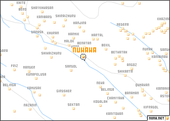
Nuwāwā (As Sulaymānīyah, Iraq)Nuwāwā is a town in the As Sulaymānīyah region of Iraq. An overview map of the region around Nuwāwā is displayed below.
regional and 3d topo map of Nuwāwā, Iraq ::
Nuwāwā airports ::
The nearest airport is TBZ - Tabriz Intl, located 244.5 km north east of Nuwāwā.
Nearby towns ::
Bēnātān (2.9km north) //
Wāra (2.8km north west) //
Sardōl (3.3km south west) //
Malōk (4.5km north west) //
Barōzha (4.9km north) //
Bēkīl (4.5km north east) //
Hartal (5.3km north east) //
Harmik (5.4km north) //
Zēwa (6.5km north) //
Dūāwān (5.4km east) //
Sarūkānī (5.4km east) //
Nēwa (6.5km south east) //
Shīwa-i Zhūrū (6.0km west) //
Hanjīra (7.5km north) //
Zīkha (6.5km north west) //
Betwātah (6.2km east) //
Andīk (6.6km east) //
Āmānj (6.7km east) //
Suwēra (7.2km north west) //
Khurān (7.7km north west) //
Bēlinga (8.3km south east) //
Gird Sher (8.6km south west) //
Shīra-i Khwārū (8.6km north west) //
Shīwa-i Khwārū (7.5km west) //
Shīkārta (7.8km south east) //
Gūlān (9.2km north east) //
Bēlāwa (10.0km north west) //
Mēdēra (9.7km north east) //
Gūlān (9.7km north east) //
[all distances 'as the bird flies' and approximate] 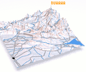 Places with similar names to Nuwāwā, Iraq ::
Disclaimer :: Information on this page comes without warranty of any kind |
||
|
Where is Nuwāwā? Elevation and coordinates ::
Latitude (lat): 36°20'9"N Longitude (lon): 44°38'31"E
Elevation (approx.): 791m (map arrows pan, magnifying glasses zoom) |
||
|
Visiting Nuwāwā? Hotel/Accommodation ::
Book a hotel in Nuwāwā Travel Guide ::
Buy a travel guide for Iraq rental cars ::
car rental offers GPS waypoint ::
download a GPX waypoint (PoI) of Nuwāwā for your GPS receiver
|
||