|
search place name
|
||
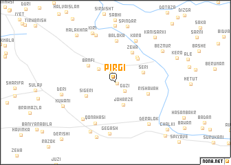
Pirgī (Dahūk, Iraq)Pirgī is a town in the Dahūk region of Iraq. An overview map of the region around Pirgī is displayed below.
regional and 3d topo map of Pirgī, Iraq ::
Pirgī airports ::
The nearest airport is VAN - Van, located 151.9 km north of Pirgī.
Nearby towns ::
Bērchī (0.3km south east) //
Dērgīnī (1.7km north) //
Gūzī (1.8km south east) //
Kurkū (3.1km north west) //
Joharze (3.8km south) //
Sēri (4.0km north east) //
Banfi (4.4km north west) //
Sigērī (4.4km south west) //
Kānī Mīrbadrī (4.9km north east) //
Shaykhān (4.9km north east) //
Rishāwah (4.6km south east) //
Zēwa (5.3km north east) //
Bālōka (6.8km north) //
Qōnāhasī (7.2km south) //
Kara (7.3km north) //
Mērakira (7.3km south west) //
Vasirki (8.1km north) //
Gēgash (8.4km south) //
Dēralōk (8.0km south east) //
Kīrī (8.5km north) //
Mizhī (8.6km south) //
Dērī (7.3km west) //
Bēznūr (7.9km north east) //
Spindār (9.2km south) //
Kuwānī (7.8km south west) //
Kānī Sārkī (9.0km north east) //
Mālākhna (9.2km north west) //
Chalkī (10.2km south east) //
Harīk (10.8km south east) //
[all distances 'as the bird flies' and approximate] 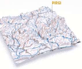 Places with similar names to Pirgī, Iraq ::
Disclaimer :: Information on this page comes without warranty of any kind |
||
|
Where is Pirgī? Elevation and coordinates ::
Latitude (lat): 37°7'0"N Longitude (lon): 43°36'0"E
Elevation (approx.): 1295m (map arrows pan, magnifying glasses zoom) |
||
|
Visiting Pirgī? Hotel/Accommodation ::
Book a hotel in Pirgī Travel Guide ::
Buy a travel guide for Iraq rental cars ::
car rental offers GPS waypoint ::
download a GPX waypoint (PoI) of Pirgī for your GPS receiver
|
||