|
search place name
|
||
Şandalīyah (Dhī Qār, Iraq)Şandalīyah is a town in the Dhī Qār region of Iraq. An overview map of the region around Şandalīyah is displayed below.
regional and 3d topo map of Şandalīyah, Iraq ::

Şandalīyah airports ::
The nearest airport is BSR - Basrah Intl, located 144.8 km east of Şandalīyah.
Other airports nearby include KWI - Kuwait Intl (253.6 km south east), Nearby towns ::
Abū Khaḑir (2.4km north west) //
‘Abd al Ghanī (4.0km north west) //
Ḩamzah (4.7km north west) //
Īshān al Ḩumayrāt (6.4km north east) //
Mudhaihija (6.4km north west) //
Muţlaq al Ḩasan (6.8km north west) //
‘Uwayjah (7.6km north) //
‘Atwī al Khālāt (8.1km north east) //
‘Arab al Ḩājj Ghathīth (9.8km north west) //
Şafḩah (9.8km north west) //
[all distances 'as the bird flies' and approximate] 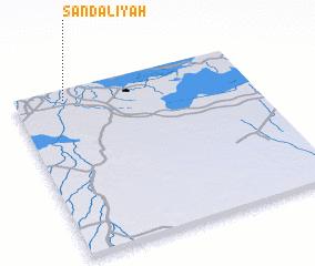 Places with similar names to Şandalīyah, Iraq ::
// Santa Olaya (ES)
// Santa Olaya (SV)
// Şandalīyah (SA)
// Santilya (TZ)
// Saint-Aulaye (FR)
// Saint-Lyé (FR)
Disclaimer :: Information on this page comes without warranty of any kind |
||
|
Where is Şandalīyah? Elevation and coordinates ::
Latitude (lat): 30°56'0"N Longitude (lon): 46°13'0"E
Elevation (approx.): 6m (map arrows pan, magnifying glasses zoom) |
||
|
Visiting Şandalīyah? Hotel/Accommodation ::
Book a hotel in Şandalīyah Travel Guide ::
Buy a travel guide for Iraq rental cars ::
car rental offers GPS waypoint ::
download a GPX waypoint (PoI) of Şandalīyah for your GPS receiver
|
||