|
search place name
|
||
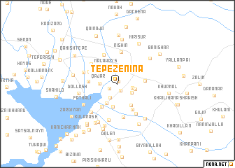
Tepe Zēnīna (As Sulaymānīyah, Iraq)Tepe Zēnīna is a town in the As Sulaymānīyah region of Iraq. An overview map of the region around Tepe Zēnīna is displayed below.
regional and 3d topo map of Tepe Zēnīna, Iraq ::
Tepe Zēnīna airports ::
The nearest airport is SDG - Sanandaj, located 95.2 km east of Tepe Zēnīna.
Other airports nearby include KSH - Bakhtaran Shahid Ashrafi Esfahani (153.0 km south east), Nearby towns ::
Tappah Rizinah (0.4km north) //
Gird-ī Şafāʼ (1.2km south) //
Kharānakān (1.3km south west) //
Tepe Tōlka (2.3km south west) //
Kunga-i Gawra (2.0km east) //
Awaī Aḩmad-i Fatḩī Karam (2.3km south east) //
Qājar (2.3km west) //
Kunga-i Pichūk (2.5km east) //
Malā Ways (3.0km north west) //
Tappah Kal (3.4km south west) //
Shukur ‘Alī (3.6km south) //
Āwaī Shaykh Ḩusayn (3.8km south east) //
Tepe Kalāwī (4.1km south west) //
Shīrāmar (3.6km east) //
Qarah Tappah (3.8km west) //
Shashik-i Shākh Husayn (4.5km south east) //
Mastakān-i Zhūrū (4.2km north west) //
Rīshin (5.1km north) //
Qulkhurd (5.0km north) //
Girdanāzī (4.6km north west) //
Bashārat-i Zhūrū (5.3km south) //
Sheshikal Ḩājjī ‘Īsá (5.3km south east) //
Mastakān (4.8km west) //
Bashārat-i Khwāru (5.9km south) //
Hāō Raqa (5.7km south west) //
Faţh ‘Alī (5.6km south west) //
Dollash (5.3km west) //
Amurah (5.9km north east) //
Jānijān (6.6km south west) //
[all distances 'as the bird flies' and approximate]  Places with similar names to Tepe Zēnīna, Iraq :: Disclaimer :: Information on this page comes without warranty of any kind |
||
|
Where is Tepe Zēnīna? Elevation and coordinates ::
Latitude (lat): 35°18'48"N Longitude (lon): 45°57'56"E
Elevation (approx.): 503m (map arrows pan, magnifying glasses zoom) |
||
|
Visiting Tepe Zēnīna? Hotel/Accommodation ::
Book a hotel in Tepe Zēnīna Travel Guide ::
Buy a travel guide for Iraq rental cars ::
car rental offers GPS waypoint ::
download a GPX waypoint (PoI) of Tepe Zēnīna for your GPS receiver
|
||