|
search place name
|
||
‘Umar Şūfī (Şalāḩ ad Dīn, Iraq)‘Umar Şūfī is a town in the Şalāḩ ad Dīn region of Iraq. An overview map of the region around ‘Umar Şūfī is displayed below.
regional and 3d topo map of ‘Umar Şūfī, Iraq ::
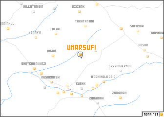
Nearby towns ::
Ḩaydar Rasūl (3.1km north east) //
Nojol (5.5km west) //
Kūshk (6.8km south) //
Ibrāhīm aş Şaghīr (6.7km south east) //
Bāsh Tappah (6.9km south west) //
Ibrāhīm al Kabīr (6.6km south east) //
Wārānī (7.2km south) //
Takhta Mina (7.5km north) //
Tālāw (7.5km north west) //
Sālī (8.3km south) //
Chāūrī (8.6km south) //
Tapah Charmūk (8.3km south west) //
Kūshk Bāshī (7.9km south west) //
Sayyid Garmūk (7.8km east) //
Tapah Charmūk (9.1km south west) //
Qal‘ah (9.7km south west) //
[all distances 'as the bird flies' and approximate] 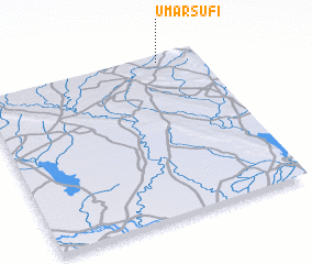 Places with similar names to ‘Umar Şūfī, Iraq :: Disclaimer :: Information on this page comes without warranty of any kind |
||
|
Where is ‘Umar Şūfī? Elevation and coordinates ::
Latitude (lat): 34°58'18"N Longitude (lon): 44°49'9"E
Elevation (approx.): 389m (map arrows pan, magnifying glasses zoom) |
||
|
Visiting ‘Umar Şūfī? Hotel/Accommodation ::
Book a hotel in ‘Umar Şūfī Travel Guide ::
Buy a travel guide for Iraq rental cars ::
car rental offers GPS waypoint ::
download a GPX waypoint (PoI) of ‘Umar Şūfī for your GPS receiver
|
||