|
search place name
|
||
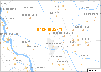
‘Umrān Ḩusayn (Bābil, Iraq)‘Umrān Ḩusayn is a town in the Bābil region of Iraq. An overview map of the region around ‘Umrān Ḩusayn is displayed below.
regional and 3d topo map of ‘Umrān Ḩusayn, Iraq ::
Nearby towns ::
Al Iskandarīyah (4.1km south) //
‘Arab Muḩammad al ‘Īfān (4.2km east) //
Ḩammūd al ‘Abbās (4.5km south east) //
Al ‘Aşrīyah (6.4km south east) //
Al Ḩaşwah (7.1km south east) //
Ni‘mah Kāz̧im (6.5km east) //
Al Laţīfīyah (7.7km north) //
Ash Shaykh ‘Alī (7.5km south west) //
Muḩammad (7.1km east) //
Khuḑayr (7.1km east) //
Salmān al Mudallil (7.3km east) //
Khalāʼif (7.7km south east) //
Abū Şayyāḩ (7.7km south west) //
Mullā ‘Abbūd (9.1km south) //
Tawfīq Fikrat (8.8km south east) //
Nawwār Salmān (9.3km north west) //
[all distances 'as the bird flies' and approximate] 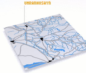 Places with similar names to ‘Umrān Ḩusayn, Iraq :: Disclaimer :: Information on this page comes without warranty of any kind |
||
|
Where is ‘Umrān Ḩusayn? Elevation and coordinates ::
Latitude (lat): 32°55'45"N Longitude (lon): 44°20'31"E
Elevation (approx.): 35m (map arrows pan, magnifying glasses zoom) |
||
|
Visiting ‘Umrān Ḩusayn? Hotel/Accommodation ::
Book a hotel in ‘Umrān Ḩusayn Travel Guide ::
Buy a travel guide for Iraq rental cars ::
car rental offers GPS waypoint ::
download a GPX waypoint (PoI) of ‘Umrān Ḩusayn for your GPS receiver
|
||