|
search place name
|
||
Zāyir (As Sulaymānīyah, Iraq)Zāyir is a town in the As Sulaymānīyah region of Iraq. An overview map of the region around Zāyir is displayed below.
regional and 3d topo map of Zāyir, Iraq ::

Zāyir airports ::
The nearest airport is SDG - Sanandaj, located 175.4 km east of Zāyir.
Nearby towns ::
Hājīāwā-i Khawārū (1.8km north east) //
Tramal Sifla (2.6km north) //
Gurgayar (2.6km east) //
Taramār-i Khwāru (4.1km north) //
Bāgh (3.5km east) //
Taramār-i Zhūrū (4.6km north west) //
Qalkand (4.7km east) //
Susākan (5.7km north west) //
Taramār-i Kōn (6.5km north) //
Tainal (6.0km south west) //
Ḩasan Tepe (5.9km north east) //
Chāqizh (5.8km east) //
Kohhig (7.5km south) //
‘Ulūw Būlāq (7.0km south west) //
Allāyī Khwarū (7.6km south east) //
Khāldān (8.6km south) //
Qāzān (8.0km north west) //
Hīāsī (8.4km south west) //
Girdābur (8.4km north east) //
Dārtū-i Saru (8.1km south east) //
Tepe Shuwānkāra (9.9km south east) //
Mōrtka (10.2km south west) //
Gaba (10.4km north west) //
[all distances 'as the bird flies' and approximate] 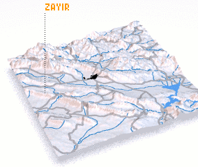 Places with similar names to Zāyir, Iraq ::
Disclaimer :: Information on this page comes without warranty of any kind |
||
|
Where is Zāyir? Elevation and coordinates ::
Latitude (lat): 35°38'36"N Longitude (lon): 45°8'20"E
Elevation (approx.): 979m (map arrows pan, magnifying glasses zoom) |
||
|
Visiting Zāyir? Hotel/Accommodation ::
Book a hotel in Zāyir Travel Guide ::
Buy a travel guide for Iraq rental cars ::
car rental offers GPS waypoint ::
download a GPX waypoint (PoI) of Zāyir for your GPS receiver
|
||