|
search place name
|
||
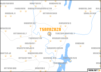
Tsarazaza (Antananarivo, Madagascar)Tsarazaza is a town in the Antananarivo region of Madagascar. An overview map of the region around Tsarazaza is displayed below.
regional and 3d topo map of Tsarazaza, Madagascar ::
Tsarazaza airports ::
The nearest airport is TNR - Antananarivo Ivato, located 54.2 km north west of Tsarazaza.
Other airports nearby include TMM - Toamasina (203.3 km north east), Nearby towns ::
Ankadilalana (1.9km south) //
Anosibe-Trimoloharano (3.5km west) //
Angodongodona (4.0km south east) //
Merikanjaka (5.1km north east) //
Ambahinia (5.1km north east) //
Tsiazompaniry-Kely (5.3km east) //
Tsarasaotra (5.6km west) //
Miadampehonina (5.8km south) //
Miandrarivo (6.4km north east) //
Antanimasaka (7.4km north) //
Masindray (7.9km south west) //
Amboronosy (7.9km north west) //
Ambohimiadana (9.1km south west) //
Alarobia (8.9km south west) //
[all distances 'as the bird flies' and approximate] 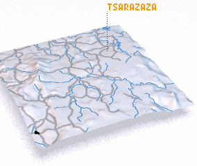 Places with similar names to Tsarazaza, Madagascar ::
// Tsarazaza (MG)
// Tsarazaza (MG)
// Tsarazaza (MG)
// Tsarazaza (MG)
// Tsarazaza (MG)
// Dessources (HT)
// Dessources (HT)
// Dessources (HT)
// Dessources (HT)
// Dessources (HT)
Disclaimer :: Information on this page comes without warranty of any kind |
||
|
Where is Tsarazaza? Elevation and coordinates ::
Latitude (lat): 19°10'0"S Longitude (lon): 47°49'0"E
Elevation (approx.): 1474m (map arrows pan, magnifying glasses zoom) |
||
|
Visiting Tsarazaza? Hotel/Accommodation ::
Book a hotel in Tsarazaza Travel Guide ::
Buy a travel guide for Madagascar rental cars ::
car rental offers GPS waypoint ::
download a GPX waypoint (PoI) of Tsarazaza for your GPS receiver
|
||