|
search place name
|
||
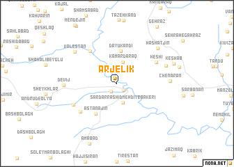
Arjelīk (Iran)Arjelīk is a town in Iran. An overview map of the region around Arjelīk is displayed below.
regional and 3d topo map of Arjelīk, Iran ::
Arjelīk airports ::
The nearest airport is RAS - Rasht, located 119.6 km east of Arjelīk.
Nearby towns ::
Kamar (1.3km south east) //
Gāv (1.5km south west) //
Sardār Rāshīd Mehdī-ye Bākerī (3.1km south) //
Kamar Daraq (3.5km north) //
Dāyū Kandī (5.2km north) //
Āstānajīn (5.5km south west) //
Senjīdeh (6.3km north west) //
Heshī (6.1km north east) //
Ţovīn (6.5km south west) //
Andrūd-e Soflá (6.5km south west) //
Zandaraq (6.9km north east) //
Valestān (7.4km north west) //
Devīj (6.8km west) //
Chenārān (6.8km east) //
Hashatjīn (7.7km north east) //
[all distances 'as the bird flies' and approximate]  Places with similar names to Arjelīk, Iran ::
// Argilaga (ES)
Disclaimer :: Information on this page comes without warranty of any kind |
||
|
Where is Arjelīk? Elevation and coordinates ::
Latitude (lat): 37°18'32"N Longitude (lon): 48°15'26"E
Elevation (approx.): 1004m (map arrows pan, magnifying glasses zoom) |
||
|
Visiting Arjelīk? Hotel/Accommodation ::
Book a hotel in Arjelīk Travel Guide ::
Buy a travel guide for Iran rental cars ::
car rental offers GPS waypoint ::
download a GPX waypoint (PoI) of Arjelīk for your GPS receiver
|
||