|
search place name
|
||
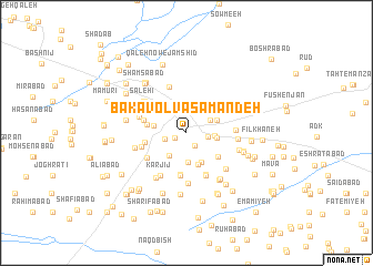
Bakāvol Va Samandeh (Khorāsān, Iran)Bakāvol Va Samandeh is a town in the Khorāsān region of Iran. An overview map of the region around Bakāvol Va Samandeh is displayed below.
regional and 3d topo map of Bakāvol Va Samandeh, Iran ::
Bakāvol Va Samandeh airports ::
The nearest airport is ASB - Ashkhabad Ashgabat, located 203.4 km north of Bakāvol Va Samandeh.
Nearby towns ::
Zargarān (1.1km south west) //
Ebrāhīmī (1.4km south east) //
Shahr-e Kohneh (1.8km east) //
Fakhrīyeh Va Kalāteh-ye Ḩabashī (1.8km east) //
Kafkadak (1.9km west) //
Neyshābūr (2.4km north) //
Ḩoseynābād (2.4km north east) //
Deh Sheykh (2.3km east) //
Qabed (2.7km south west) //
Shāhābād (3.0km south) //
Yaḩyáābād (2.6km east) //
Chāh Boland (2.8km north east) //
Dehnow-e Lagzī (3.2km south east) //
Şāleḩābād (2.8km west) //
Ḩaqqīyeh (3.3km south) //
Emāmzādeh (3.5km south east) //
Chambarān (3.3km west) //
Amīnābād (4.2km south) //
Faraḩābād (3.5km west) //
Moḩammadābād (4.3km south) //
Raḩmatābād (3.7km west) //
Ḩoseynābād-e Salāmī (3.7km west) //
Raḩīmābād (3.7km west) //
Bahmān (4.5km south) //
Anjīdān (3.9km west) //
Jūrī (4.6km south) //
Shād Mehrak (4.1km south west) //
‘Eynābād (4.0km east) //
Taqīābād-e Qavām (4.0km east) //
[all distances 'as the bird flies' and approximate] 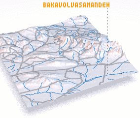 Places with similar names to Bakāvol Va Samandeh, Iran :: Disclaimer :: Information on this page comes without warranty of any kind |
||
|
Where is Bakāvol Va Samandeh? Elevation and coordinates ::
Latitude (lat): 36°11'19"N Longitude (lon): 58°48'17"E
Elevation (approx.): 1185m (map arrows pan, magnifying glasses zoom) |
||
|
Visiting Bakāvol Va Samandeh? Hotel/Accommodation ::
Book a hotel in Bakāvol Va Samandeh Travel Guide ::
Buy a travel guide for Iran rental cars ::
car rental offers GPS waypoint ::
download a GPX waypoint (PoI) of Bakāvol Va Samandeh for your GPS receiver
|
||