|
search place name
|
||
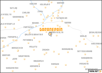
Dārān-e Pāʼīn (Hamadān, Iran)Dārān-e Pāʼīn is a town in the Hamadān region of Iran. An overview map of the region around Dārān-e Pāʼīn is displayed below.
regional and 3d topo map of Dārān-e Pāʼīn, Iran ::
Dārān-e Pāʼīn airports ::
The nearest airport is KSH - Bakhtaran Shahid Ashrafi Esfahani, located 116.3 km west of Dārān-e Pāʼīn.
Other airports nearby include SDG - Sanandaj (152.6 km north west), Nearby towns ::
Dārānī-ye ‘Olyā (1.8km east) //
Noqqadeh (2.3km north west) //
Mālīcheh (4.0km south west) //
Qal‘eh Qāzī (4.5km north east) //
Emāmzādeh Zeyd (4.5km north east) //
Ja‘farīyeh (4.7km north west) //
Būstāndar (5.6km south) //
Qal‘eh-ye Sheykh (5.6km north west) //
Rūd Āvar (5.8km north) //
Qal‘eh-ye Bakhtīār (5.1km west) //
Zāgheh (6.2km south) //
Ārīkān (6.0km north west) //
Qal‘eh-ye Ajal Beyg (6.8km north) //
Najafīyeh (6.7km north) //
Tūyserkān (6.5km north east) //
Qal‘eh-ye Āqā Beyg (6.9km north) //
Darvāz (6.8km south) //
Ya‘qūbābād (6.9km south) //
Kalābād (7.3km north) //
Sarābī (6.6km north east) //
Dorūdān (7.7km north) //
Golābād (7.7km north) //
Ḩājjītū (7.1km south west) //
Maḩmūdābād (6.7km west) //
‘Eynābād (7.9km north) //
Faryāzān (7.1km west) //
Aḩmadābād (7.7km south east) //
Fatḩābād (7.2km west) //
Mobārakābād (8.6km north) //
[all distances 'as the bird flies' and approximate] 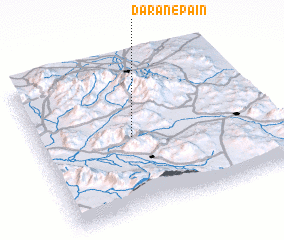 Places with similar names to Dārān-e Pāʼīn, Iran :: Disclaimer :: Information on this page comes without warranty of any kind |
||
|
Where is Dārān-e Pāʼīn? Elevation and coordinates ::
Latitude (lat): 34°29'52"N Longitude (lon): 48°24'37"E
Elevation (approx.): 1802m (map arrows pan, magnifying glasses zoom) |
||
|
Visiting Dārān-e Pāʼīn? Hotel/Accommodation ::
Book a hotel in Dārān-e Pāʼīn Travel Guide ::
Buy a travel guide for Iran rental cars ::
car rental offers GPS waypoint ::
download a GPX waypoint (PoI) of Dārān-e Pāʼīn for your GPS receiver
|
||