|
search place name
|
||
Dar-e Sādegī (Iran)Dar-e Sādegī is a town in Iran. An overview map of the region around Dar-e Sādegī is displayed below.
regional and 3d topo map of Dar-e Sādegī, Iran ::

Dar-e Sādegī airports ::
The nearest airport is KER - Kerman, located 114.0 km south east of Dar-e Sādegī.
Nearby towns ::
Dar-e Gāvān (4.0km south west) //
Mūrdar (4.0km north west) //
Bāskūl (4.0km south east) //
Pābīdnān-e Bālā (4.4km east) //
Dar-e Zangalān (4.8km east) //
Dar-e Kerū (4.8km east) //
Darkarū (4.8km east) //
Ţoghr ol Jerd (5.4km south west) //
Bāghhā-ye Sar Āsīāb (5.8km south) //
‘Abbāsābād (6.0km west) //
Āb Līshū (6.6km west) //
Kāz̧emābād (7.3km south west) //
Shahrak-e Pābedānā (8.0km south west) //
Sheyk Shams (8.1km north west) //
Deh-e ‘Abbās-e Kalmoḩammad (8.8km south east) //
Bāgh-e Pahn (8.8km north west) //
Dar Khoshkī (9.8km north west) //
[all distances 'as the bird flies' and approximate] 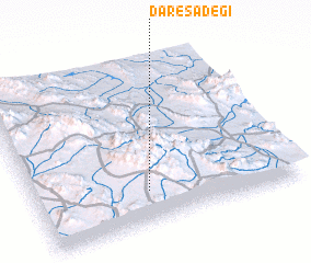
Disclaimer :: Information on this page comes without warranty of any kind |
||
|
Where is Dar-e Sādegī? Elevation and coordinates ::
Latitude (lat): 31°12'0"N Longitude (lon): 56°26'0"E
Elevation (approx.): 2644m (map arrows pan, magnifying glasses zoom) |
||
|
Visiting Dar-e Sādegī? Hotel/Accommodation ::
Book a hotel in Dar-e Sādegī Travel Guide ::
Buy a travel guide for Iran rental cars ::
car rental offers GPS waypoint ::
download a GPX waypoint (PoI) of Dar-e Sādegī for your GPS receiver
|
||