|
search place name
|
||
Dastgīr (Ardabīl, Iran)Dastgīr is a town in the Ardabīl region of Iran. An overview map of the region around Dastgīr is displayed below.
regional and 3d topo map of Dastgīr, Iran ::

Dastgīr airports ::
The nearest airport is TBZ - Tabriz Intl, located 132.1 km west of Dastgīr.
Other airports nearby include RAS - Rasht (211.9 km south east), Nearby towns ::
Beyḩaq (0.9km south) //
‘Arablū (1.5km north east) //
Bījaq (1.9km north east) //
Bārezīl (2.4km south west) //
Āgh Daraq (2.8km north) //
Gellar-e Moḩammadtaqī (2.8km north) //
Pāshālū (3.1km north west) //
Qareh Tappeh (2.6km west) //
Vārghūl (3.5km south) //
Kūr Bolāgh (3.2km east) //
Naşīrābād (4.1km south) //
Lūshlī (4.3km north west) //
Bārīs (4.8km north) //
Ālnī (4.3km south east) //
Savāreh (4.9km north) //
‘Alī Moḩammadlū (4.9km north) //
Parīkhān (5.4km south west) //
Dowlatābād (6.8km south) //
Perī Khān (7.1km south west) //
Khvājeh ‘Alī (6.9km north west) //
Meshgīn Shahr (8.0km south) //
Khīāv (7.9km south) //
Kūt Tappeh (7.1km south west) //
Qarah Darvīsh (8.3km south) //
Sārebānlār (7.9km south east) //
‘Arablū (8.0km south east) //
Ja‘farābād (8.4km south east) //
Qūrt Tappeh (8.6km south west) //
Jalāyer (8.8km north east) //
[all distances 'as the bird flies' and approximate] 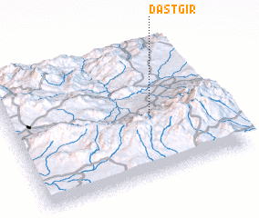 Places with similar names to Dastgīr, Iran ::
// Dostagir (AZ)
Disclaimer :: Information on this page comes without warranty of any kind |
||
|
Where is Dastgīr? Elevation and coordinates ::
Latitude (lat): 38°28'30"N Longitude (lon): 47°40'55"E
Elevation (approx.): 1120m (map arrows pan, magnifying glasses zoom) |
||
|
Visiting Dastgīr? Hotel/Accommodation ::
Book a hotel in Dastgīr Travel Guide ::
Buy a travel guide for Iran rental cars ::
car rental offers GPS waypoint ::
download a GPX waypoint (PoI) of Dastgīr for your GPS receiver
|
||