|
search place name
|
||
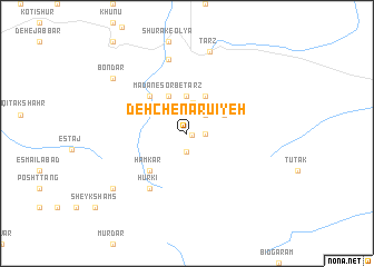
Deh Chenārū'īyeh (Kermān, Iran)Deh Chenārū'īyeh is a town in the Kermān region of Iran. An overview map of the region around Deh Chenārū'īyeh is displayed below.
regional and 3d topo map of Deh Chenārū'īyeh, Iran ::
Deh Chenārū'īyeh airports ::
The nearest airport is KER - Kerman, located 125.6 km south of Deh Chenārū'īyeh.
Nearby towns ::
Fūz (0.5km east) //
Dar Āb (1.9km south) //
Sīneh Kū'īyeh (1.6km east) //
Dehū'īyeh (2.4km north east) //
Rob‘-e Kohan (2.4km north east) //
Sarmūr (2.4km north east) //
Darshūr-e Pā'īn (2.4km north east) //
Deymeskān (3.1km north) //
Āb Korū'īyeh (3.7km north) //
Darshūr-e Bālā (3.7km north) //
Ma‘dan-e Sorb-e Ţarz (4.0km north west) //
Kahnūj (4.0km north east) //
Noşratābād (3.7km north east) //
Hamkār (4.9km south west) //
‘Alīābād (4.9km north west) //
Darpīdanūn (6.4km south west) //
Ḩūrkī (6.4km south west) //
Kārgāh-e Felezzāte-e Yazd (7.6km north) //
Ţarz (8.4km north) //
Bondar (8.4km north west) //
Bāgh-e Dar Mūrīn (8.4km south west) //
[all distances 'as the bird flies' and approximate] 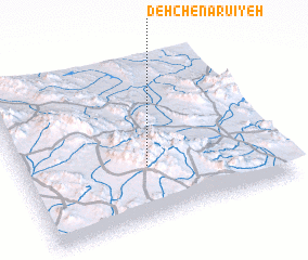 Places with similar names to Deh Chenārū'īyeh, Iran :: Disclaimer :: Information on this page comes without warranty of any kind |
||
|
Where is Deh Chenārū'īyeh? Elevation and coordinates ::
Latitude (lat): 31°20'0"N Longitude (lon): 56°29'0"E
Elevation (approx.): 2313m (map arrows pan, magnifying glasses zoom) |
||
|
Visiting Deh Chenārū'īyeh? Hotel/Accommodation ::
Book a hotel in Deh Chenārū'īyeh Travel Guide ::
Buy a travel guide for Iran rental cars ::
car rental offers GPS waypoint ::
download a GPX waypoint (PoI) of Deh Chenārū'īyeh for your GPS receiver
|
||