|
search place name
|
||
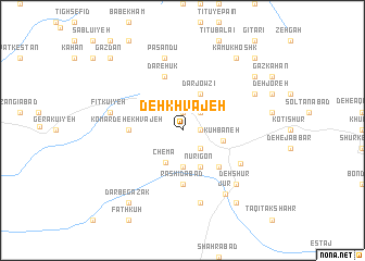
Deh Khvājeh (Iran)Deh Khvājeh is a town in Iran. An overview map of the region around Deh Khvājeh is displayed below.
regional and 3d topo map of Deh Khvājeh, Iran ::
Deh Khvājeh airports ::
The nearest airport is KER - Kerman, located 144.9 km south east of Deh Khvājeh.
Other airports nearby include AZD - Yazd Shahid Sadooghi (194.3 km west), Nearby towns ::
Āsīāb-e Hashtom (1.9km north) //
Dehmalek (1.6km east) //
Āsīāb-e Avval (1.6km east) //
Bāgh-e Amīrābād (1.6km east) //
Bāghestān-e Bāgh Bālā (1.6km east) //
Dar Shūʼīyeh (2.4km south east) //
Moqīmābād (2.4km south east) //
Deh Sālār (2.4km south east) //
Deh NowY-ye Khvājeh (2.4km south east) //
Dar Shū (2.4km south east) //
Āsīāb-e Sheshom (2.4km north east) //
Āsīāb-e Chahārom (2.4km north east) //
Afzād (3.4km north east) //
Āb Kapkān (3.7km south) //
Chemāʼ (3.6km south west) //
NūrīGon (4.0km south east) //
Darjowzī (4.0km north east) //
Kūh Baneh (3.7km east) //
Fīrūzābād (4.9km south east) //
Komārdeh-e Khvājeh (4.7km west) //
Rashīdābād (5.6km south) //
Deh Mīr (5.6km south) //
Dar-e Hūk (5.8km north) //
Āpūrvār-e Pā'īn (6.1km south east) //
Esmā‘īlābād (7.6km south) //
Deh Shīr (6.6km west) //
Fītkū'īyeh (6.6km west) //
Dar Dehūk (7.6km north) //
Pasandū (7.6km north) //
[all distances 'as the bird flies' and approximate]  Places with similar names to Deh Khvājeh, Iran ::
// Deh Khvājeh (IR)
// Deh Khvājeh (IR)
Disclaimer :: Information on this page comes without warranty of any kind |
||
|
Where is Deh Khvājeh? Elevation and coordinates ::
Latitude (lat): 31°26'0"N Longitude (lon): 56°15'0"E
Elevation (approx.): 2133m (map arrows pan, magnifying glasses zoom) |
||
|
Visiting Deh Khvājeh? Hotel/Accommodation ::
Book a hotel in Deh Khvājeh Travel Guide ::
Buy a travel guide for Iran rental cars ::
car rental offers GPS waypoint ::
download a GPX waypoint (PoI) of Deh Khvājeh for your GPS receiver
|
||