|
search place name
|
||
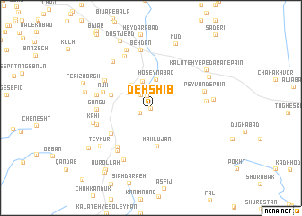
Deh Shīb (Khorāsān, Iran)Deh Shīb is a town in the Khorāsān region of Iran. An overview map of the region around Deh Shīb is displayed below.
regional and 3d topo map of Deh Shīb, Iran ::
Deh Shīb airports ::
The nearest airport is XBJ - Birjand, located 36.7 km north west of Deh Shīb.
Nearby towns ::
‘Alīābād (0.0km north) //
Shavākand (1.3km south west) //
Fanūd (1.5km north) //
Kalāteh-ye Ḩājjī Gholām (2.0km north west) //
Kafūzak (2.2km north east) //
Khāvāz (2.2km north east) //
Bāsnābād (2.2km north east) //
Chahkand (3.4km north) //
Ḩoseynābād (3.6km north) //
Kalāteh-ye Bāzdīd (3.5km north west) //
Maḩlūjān (4.8km south) //
Chāhābād (4.5km west) //
Harīvand (5.2km south west) //
Nūk (5.4km west) //
Qūzg (6.0km south west) //
Mowrūtak-e Bālā (5.9km north west) //
Boghnag (6.4km south west) //
Gurgū (5.7km west) //
Kalāteh-ye Māllāleh (5.9km east) //
Peyvand-e Pā'īn (6.0km east) //
Ghīās̄ ed Dīn (6.0km west) //
Ḩājjīābād (6.1km west) //
‘Alī Shāh (7.0km north west) //
Kalāteh-ye ‘Alī (7.1km south west) //
Behdān (7.3km north) //
Kāhī (6.3km west) //
Samsūlābād (7.0km north west) //
Teymūrī (7.1km south west) //
Nau‘qeh Khvājeh ‘Al (7.7km north) //
[all distances 'as the bird flies' and approximate] 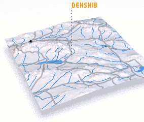 Places with similar names to Deh Shīb, Iran ::
Disclaimer :: Information on this page comes without warranty of any kind |
||
|
Where is Deh Shīb? Elevation and coordinates ::
Latitude (lat): 32°39'6"N Longitude (lon): 59°31'40"E
Elevation (approx.): 1949m (map arrows pan, magnifying glasses zoom) |
||
|
Visiting Deh Shīb? Hotel/Accommodation ::
Book a hotel in Deh Shīb Travel Guide ::
Buy a travel guide for Iran rental cars ::
car rental offers GPS waypoint ::
download a GPX waypoint (PoI) of Deh Shīb for your GPS receiver
|
||