|
search place name
|
||
‘Emārat (Ostān-e Kohgīlūyeh va Būyer Aḩmad, Iran)‘Emārat is a town in the Ostān-e Kohgīlūyeh va Būyer Aḩmad region of Iran. An overview map of the region around ‘Emārat is displayed below.
regional and 3d topo map of ‘Emārat, Iran ::

‘Emārat airports ::
The nearest airport is MRX - Bandar Mahshahr Mahshahr, located 149.3 km west of ‘Emārat.
Other airports nearby include QMJ - Masjed Soleiman Shahid Asyaee (174.1 km north west), AWZ - Ahwaz (183.9 km west), SYZ - Shiraz Shahid Dastghaib Intl (244.9 km south east), Nearby towns ::
Dermen-e Pā'īn (1.2km south west) //
Dermen-e Bālā (1.2km south west) //
Darreh Ney (1.4km north west) //
Qal‘eh-ye Gol (2.5km south west) //
Pātāveh (2.8km north) //
Sheykh Hābīl-e Vostá (3.3km south east) //
Qal‘eh Dokhtar (3.6km south west) //
Sarţūf (3.7km north west) //
Gāv Dāneh (3.9km west) //
Sheykh Hābīl-e Soflá (4.3km east) //
Bar Āftāb-e ‘Olyā (4.6km north west) //
Bar Āftāb-e Vosţá (4.6km north west) //
Gāv Mordār (4.8km north west) //
Darreh Garm (5.1km south east) //
Bīdak Āb (5.1km south east) //
Bīdak (5.0km east) //
Talkhdān (5.8km north east) //
Dashtak-e ‘Olyā (6.2km north) //
Dashtak-e Soflá (6.5km north) //
Andarūn (6.5km north east) //
Sar Darreh (6.6km north) //
Sheykh Hābīl-e ‘Olyā (5.8km east) //
Chūrak-e Bālā (5.8km east) //
Bar Āftāb-e Soflá (6.0km north west) //
Dasht-e Qāẕī (6.0km north west) //
Chūrak-e Pā'īn (6.4km south east) //
Nowz̄ar (6.4km south east) //
Tang-e Hījān-e Bālā (7.0km south west) //
Zīrnā-ye ‘Olyā (7.7km north) //
[all distances 'as the bird flies' and approximate] 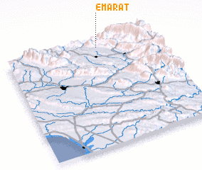 Places with similar names to ‘Emārat, Iran ::
Disclaimer :: Information on this page comes without warranty of any kind |
||
|
Where is ‘Emārat? Elevation and coordinates ::
Latitude (lat): 30°57'34"N Longitude (lon): 50°38'24"E
Elevation (approx.): 910m (map arrows pan, magnifying glasses zoom) |
||
|
Visiting ‘Emārat? Hotel/Accommodation ::
Book a hotel in ‘Emārat Travel Guide ::
Buy a travel guide for Iran rental cars ::
car rental offers GPS waypoint ::
download a GPX waypoint (PoI) of ‘Emārat for your GPS receiver
|
||