|
search place name
|
||
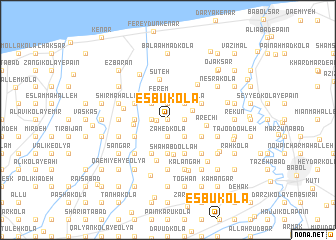
Esbū Kolā (Iran)Esbū Kolā is a town in Iran. An overview map of the region around Esbū Kolā is displayed below.
regional and 3d topo map of Esbū Kolā, Iran ::
Esbū Kolā airports ::
The nearest airport is THR - Teheran Mehrabad Intl, located 150.3 km south west of Esbū Kolā.
Other airports nearby include RZR - Ramsar (170.5 km west), Nearby towns ::
Pā'īn Esbū Kolā (0.0km north) //
Jezīn (1.0km west) //
Bālā Esbū Kolā (1.5km west) //
Ḩeydar Kolā (1.9km north) //
Shāreh (1.5km east) //
Darzī Kolā (1.9km south) //
Zāhed Kolā (1.9km south) //
Shāh Kolā (1.9km south) //
Mollā Kolā (1.9km north) //
Kolā Gar Sarā (2.4km north west) //
Sherāmetān (2.4km north east) //
Kerfū Kolā (2.4km south east) //
Sormeh Kolā (2.4km north east) //
Mīān Bāl (2.4km north east) //
Tavakkol (2.4km south east) //
Valīk Rūdposht (2.4km north east) //
Ferem (2.8km north) //
Dūghīkolā (2.5km north east) //
Ţūleh Sarā (3.0km west) //
Nomūdār Kolā (3.7km south) //
Shāh ‘Abdollāh (3.9km south) //
Bīnamad (3.2km west) //
Zīār Kolā (3.5km south west) //
Ghīās̄ Kolā (3.5km south west) //
Monqār Pey (3.5km north west) //
Bīsh Maḩalleh (4.0km south) //
Kūner (3.5km north east) //
Sobḩān Kolā (3.5km north east) //
Raz Kenār (3.5km north east) //
[all distances 'as the bird flies' and approximate] 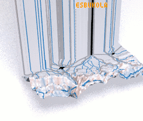 Places with similar names to Esbū Kolā, Iran ::
Disclaimer :: Information on this page comes without warranty of any kind |
||
|
Where is Esbū Kolā? Elevation and coordinates ::
Latitude (lat): 36°36'0"N Longitude (lon): 52°33'0"E
Elevation (approx.): -13m (map arrows pan, magnifying glasses zoom) |
||
|
Visiting Esbū Kolā? Hotel/Accommodation ::
Book a hotel in Esbū Kolā Travel Guide ::
Buy a travel guide for Iran rental cars ::
car rental offers GPS waypoint ::
download a GPX waypoint (PoI) of Esbū Kolā for your GPS receiver
|
||