|
search place name
|
||
Fīrūz Nowk (Khorāsān, Iran)Fīrūz Nowk is a town in the Khorāsān region of Iran. An overview map of the region around Fīrūz Nowk is displayed below.
regional and 3d topo map of Fīrūz Nowk, Iran ::

Fīrūz Nowk airports ::
The nearest airport is XBJ - Birjand, located 13.6 km south east of Fīrūz Nowk.
Nearby towns ::
Kalāteh-ye Karbalāʼī Ḩoseyn (1.9km south) //
Pāy Godār-e Ḩowẕ (2.4km north east) //
Ferīznūk (3.6km north) //
Kalāteh-ye Karbalā'ī ‘Abbās (3.7km south) //
Māseh Qanat (3.7km north) //
Seytūn (5.7km north) //
Pey Godār (5.4km north east) //
Chāh Ḩowẕ (5.8km east) //
Tofang Sāzān (6.3km south east) //
Kalāteh-ye Moḩammad ‘Al (6.3km south east) //
Kalāteh-ye Mīr Ḩoseyn (6.4km north west) //
Tangal-e Bālā (6.4km east) //
Tangal Pā'īn (6.4km east) //
Shekar Āb (7.0km south east) //
Āsīāb-e Kheyrābād (8.2km south east) //
Kul-e Sīnu (7.6km south east) //
Kalāteh-yeḨājjī Yūsef (8.8km north) //
Kalāteh-ye Mīrzā Ḩasan-e Kermān (9.0km south east) //
[all distances 'as the bird flies' and approximate] 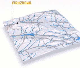 Places with similar names to Fīrūz Nowk, Iran ::
// Varzenga (RU)
// Fresing (AT)
// Friesenegg (AT)
// Freising (DE)
// Friesing (DE)
// Phra Saeng (TH)
// Forasinka (GN)
// Farsangu (NG)
// Frisanco (IT)
// Vřesník (CZ)
Disclaimer :: Information on this page comes without warranty of any kind |
||
|
Where is Fīrūz Nowk? Elevation and coordinates ::
Latitude (lat): 32°59'0"N Longitude (lon): 59°9'42"E
Elevation (approx.): 1821m (map arrows pan, magnifying glasses zoom) |
||
|
Visiting Fīrūz Nowk? Hotel/Accommodation ::
Book a hotel in Fīrūz Nowk Travel Guide ::
Buy a travel guide for Iran rental cars ::
car rental offers GPS waypoint ::
download a GPX waypoint (PoI) of Fīrūz Nowk for your GPS receiver
|
||