|
search place name
|
||
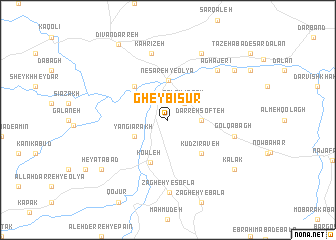
Gheybī Sūr (Kordestān, Iran)Gheybī Sūr is a town in the Kordestān region of Iran. An overview map of the region around Gheybī Sūr is displayed below.
regional and 3d topo map of Gheybī Sūr, Iran ::
Gheybī Sūr airports ::
The nearest airport is SDG - Sanandaj, located 65.5 km south of Gheybī Sūr.
Other airports nearby include KSH - Bakhtaran Shahid Ashrafi Esfahani (165.2 km south), Nearby towns ::
Qal'eh Joqeh (2.4km north east) //
Darreh Softeh (3.0km east) //
Yangī Arakh (3.5km south west) //
Nesāreh-ye ‘Olyā (4.4km north) //
Kowleh (5.0km south) //
Qareh Gheybī (4.8km north west) //
Kūd Zīrāveh (4.8km south east) //
Gol Qabāgh (6.3km east) //
Kahrīzeh (7.6km north) //
Āghājerī (7.2km north east) //
Zāgheh-ye Soflá (8.1km south) //
Barakeh (8.0km north) //
Hey'atābād (8.2km south west) //
Nesāreh-ye Soflá (8.2km north east) //
Kalak (8.2km south east) //
Dīvān Darreh (9.6km north west) //
[all distances 'as the bird flies' and approximate] 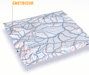 Places with similar names to Gheybī Sūr, Iran ::
// Viehbighäuser (DE)
// Fabassira (ML)
Disclaimer :: Information on this page comes without warranty of any kind |
||
|
Where is Gheybī Sūr? Elevation and coordinates ::
Latitude (lat): 35°50'0"N Longitude (lon): 47°5'0"E
Elevation (approx.): 1899m (map arrows pan, magnifying glasses zoom) |
||
|
Visiting Gheybī Sūr? Hotel/Accommodation ::
Book a hotel in Gheybī Sūr Travel Guide ::
Buy a travel guide for Iran rental cars ::
car rental offers GPS waypoint ::
download a GPX waypoint (PoI) of Gheybī Sūr for your GPS receiver
|
||