|
search place name
|
||
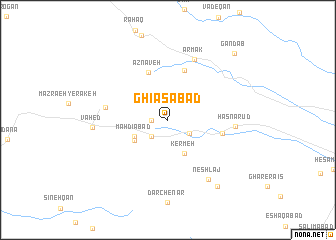
Ghīās̄ābād (Eşfahān, Iran)Ghīās̄ābād is a town in the Eşfahān region of Iran. An overview map of the region around Ghīās̄ābād is displayed below.
regional and 3d topo map of Ghīās̄ābād, Iran ::
Ghīās̄ābād airports ::
The nearest airport is THR - Teheran Mehrabad Intl, located 183.6 km north of Ghīās̄ābād.
Nearby towns ::
Lārān (1.5km west) //
Jūshaq (1.5km west) //
Rījān (1.5km west) //
Mashhad Ardahār (2.4km south west) //
Bārī Karafs (2.5km south east) //
Kermeh (4.0km south east) //
Mahdīābād (3.6km south west) //
Kareh Chār (3.9km south west) //
Aznāveh (5.6km north) //
‘Alīābād (5.8km north) //
‘Alīābād (5.2km east) //
Khāveh (5.9km west) //
Ārmak (7.2km north) //
Ḩasnā Rūd (6.3km east) //
Neshlaj (7.6km south east) //
Vāḩed (7.1km west) //
Nezār (8.7km south east) //
Gandāb (9.6km north east) //
[all distances 'as the bird flies' and approximate] 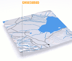 Places with similar names to Ghīās̄ābād, Iran ::
Disclaimer :: Information on this page comes without warranty of any kind |
||
|
Where is Ghīās̄ābād? Elevation and coordinates ::
Latitude (lat): 34°3'0"N Longitude (lon): 51°2'0"E
Elevation (approx.): 1871m (map arrows pan, magnifying glasses zoom) |
||
|
Visiting Ghīās̄ābād? Hotel/Accommodation ::
Book a hotel in Ghīās̄ābād Travel Guide ::
Buy a travel guide for Iran rental cars ::
car rental offers GPS waypoint ::
download a GPX waypoint (PoI) of Ghīās̄ābād for your GPS receiver
|
||