|
search place name
|
||
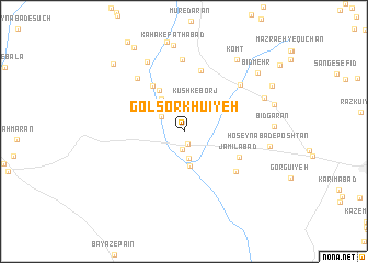
Gol Sorkhū'īyeh (Kermān, Iran)Gol Sorkhū'īyeh is a town in the Kermān region of Iran. An overview map of the region around Gol Sorkhū'īyeh is displayed below.
regional and 3d topo map of Gol Sorkhū'īyeh, Iran ::
Gol Sorkhū'īyeh airports ::
The nearest airport is KER - Kerman, located 122.2 km north east of Gol Sorkhū'īyeh.
Nearby towns ::
Deh Now (1.3km south) //
Ārdābīn (1.8km south) //
Fatḩābād (2.1km north) //
Sharīkābād (2.7km north) //
Shīrū'īyeh (2.5km north west) //
Palās Ābdān (2.7km south) //
Kūshk-e Borj (3.3km north) //
Gījū`īyeh (3.6km south) //
Āderenjān (3.8km north west) //
Henkū'īyeh (4.7km north west) //
Sefteh-ye Fatḩābād (5.0km north east) //
Bīd Kordū'īyeh (5.4km north west) //
Jamīlābād (5.6km south east) //
Sang-e Pahn (6.4km north) //
Govān (6.2km south east) //
Zar Dasht (6.8km north west) //
Kūk (7.3km north) //
Hormū'īyeh (7.3km north) //
Şāleḩābād (6.8km north east) //
Kahak-e Zardasht (7.8km north west) //
Ḩoseynābād-e Poshtān (7.7km east) //
Kahak-e Fatḩābād (8.8km north) //
Raḩmatābād (7.9km north east) //
Komt (8.7km north east) //
Bīd Mehr (8.9km north east) //
Banehābād-e Bālā (9.3km north west) //
Banehābād-e Bālā (9.6km north west) //
[all distances 'as the bird flies' and approximate] 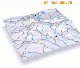 Places with similar names to Gol Sorkhū'īyeh, Iran :: Disclaimer :: Information on this page comes without warranty of any kind |
||
|
Where is Gol Sorkhū'īyeh? Elevation and coordinates ::
Latitude (lat): 29°16'4"N Longitude (lon): 56°26'6"E
Elevation (approx.): 2261m (map arrows pan, magnifying glasses zoom) |
||
|
Visiting Gol Sorkhū'īyeh? Hotel/Accommodation ::
Book a hotel in Gol Sorkhū'īyeh Travel Guide ::
Buy a travel guide for Iran rental cars ::
car rental offers GPS waypoint ::
download a GPX waypoint (PoI) of Gol Sorkhū'īyeh for your GPS receiver
|
||