|
search place name
|
||
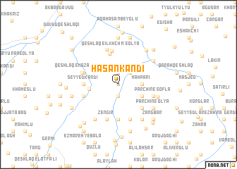
Ḩasan Kandī (Ostān-e Āz̄arbāyjān-e Gharbī, Iran)Ḩasan Kandī is a town in the Ostān-e Āz̄arbāyjān-e Gharbī region of Iran. An overview map of the region around Ḩasan Kandī is displayed below.
regional and 3d topo map of Ḩasan Kandī, Iran ::
Ḩasan Kandī airports ::
The nearest airport is TBZ - Tabriz Intl, located 200.7 km south west of Ḩasan Kandī.
Other airports nearby include BAK - Baku Heydar Aliyev (220.3 km north east), RAS - Rasht (233.1 km south east), Nearby towns ::
Amrāhlū (0.0km north) //
Qahramānlū (1.9km north) //
Ḩamzah Khānlū (1.9km south) //
Azhdarlū (2.3km north east) //
Māh Parī (2.9km east) //
Gūk Pāpākh (2.9km east) //
Khān Bolāghī (3.4km south east) //
Chūneh Khānlū (3.7km west) //
Qeshlāq-e Īlkhchī-ye Soflá (5.0km north) //
Sīāvosh (4.7km south east) //
Qeshlāq-e Īlkhchī-ye ‘Olyā (5.3km north) //
Hāchākand-e Darmānlū (5.6km south) //
Sīneh Sar (5.6km south) //
Seyyed Kandī (4.3km west) //
Ḩavās Kandī (5.7km north) //
Zengīr (5.7km south) //
Ojāq Ālāzār (5.7km south) //
Parchīn-e Soflá (4.7km south east) //
Şaghīrlū (4.7km south west) //
Ḩājjī Ḩasan Dāghī (4.7km north west) //
Darmānlū (5.7km south) //
Tappeh Ayāz (4.7km north west) //
Qeshlāq-e Māzān-e ‘Olyā (4.8km north west) //
Darvish Gūrūnmaz (5.2km east) //
Tappeh Bāshī (5.7km north east) //
Akbarābād (5.7km north east) //
Parchīn-e ‘Olyā (5.7km south east) //
Alqanāb (6.3km south west) //
Shelveh-ye Soflá (6.3km south east) //
[all distances 'as the bird flies' and approximate] 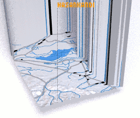 Places with similar names to Ḩasan Kandī, Iran ::
// Hasankendi (TR)
// Hasankendi (TR)
// Hāsankāndi (BD)
// Ḩasan Kandī (IR)
// Ḩasan Kandī (IR)
// Ḩasan Kandī (IR)
// Ḩasan Kandī (IR)
// Ḩasan Qandī (IR)
// Ḩoseyn Kandī (IR)
// Hussaini Kandao (PK)
Disclaimer :: Information on this page comes without warranty of any kind |
||
|
Where is Ḩasan Kandī? Elevation and coordinates ::
Latitude (lat): 39°6'0"N Longitude (lon): 48°11'0"E
Elevation (approx.): 474m (map arrows pan, magnifying glasses zoom) |
||
|
Visiting Ḩasan Kandī? Hotel/Accommodation ::
Book a hotel in Ḩasan Kandī Travel Guide ::
Buy a travel guide for Iran rental cars ::
car rental offers GPS waypoint ::
download a GPX waypoint (PoI) of Ḩasan Kandī for your GPS receiver
|
||